You are here: Home > Network List > UW - Pacific Northwest Regional Seismic Network Stations List
> Station IRON Crane, OR, USA > Earthquake Result Viewer
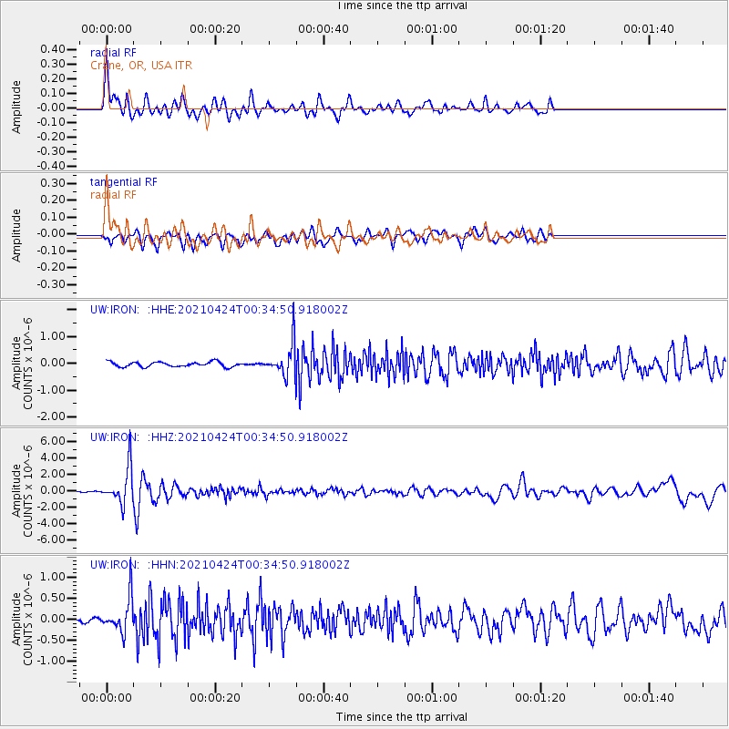
IRON Crane, OR, USA - Earthquake Result Viewer
*The percent match for this event was below the threshold and hence no stack was calculated.
| Earthquake location: |
Fiji Islands Region |
| Earthquake latitude/longitude: |
-18.9/-176.2 |
| Earthquake time(UTC): |
2021/04/24 (114) 00:23:36 GMT |
| Earthquake Depth: |
289 km |
| Earthquake Magnitude: |
6.4 Mww |
| Earthquake Catalog/Contributor: |
NEIC PDE/us |
|
| Network: |
UW Pacific Northwest Regional Seismic Network |
| Station: |
IRON Crane, OR, USA |
| Lat/Lon: |
43.36 N/118.47 W |
| Elevation: |
1226 m |
|
| Distance: |
81.5 deg |
| Az: |
38.593 deg |
| Baz: |
234.056 deg |
| Ray Param: |
$rayparam |
*The percent match for this event was below the threshold and hence was not used in the summary stack. |
|
| Radial Match: |
79.50298 % |
| Radial Bump: |
400 |
| Transverse Match: |
73.441185 % |
| Transverse Bump: |
400 |
| SOD ConfigId: |
24334971 |
| Insert Time: |
2021-05-08 00:56:45.054 +0000 |
| GWidth: |
2.5 |
| Max Bumps: |
400 |
| Tol: |
0.001 |
|
Signal To Noise
| Channel | StoN | STA | LTA |
| UW:IRON: :HHZ:20210424T00:34:50.918002Z | 20.735485 | 2.2907632E-6 | 1.1047551E-7 |
| UW:IRON: :HHN:20210424T00:34:50.918002Z | 2.6003175 | 4.2170737E-7 | 1.6217535E-7 |
| UW:IRON: :HHE:20210424T00:34:50.918002Z | 6.6403103 | 5.9457415E-7 | 8.954011E-8 |
| Arrivals |
| Ps | |
| PpPs | |
| PsPs/PpSs | |


