You are here: Home > Network List > UW - Pacific Northwest Regional Seismic Network Stations List
> Station YACT Amboy, WA, USA > Earthquake Result Viewer
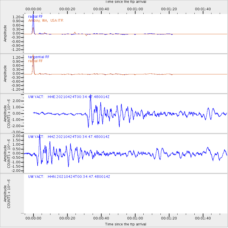
YACT Amboy, WA, USA - Earthquake Result Viewer
*The percent match for this event was below the threshold and hence no stack was calculated.
| Earthquake location: |
Fiji Islands Region |
| Earthquake latitude/longitude: |
-18.9/-176.2 |
| Earthquake time(UTC): |
2021/04/24 (114) 00:23:36 GMT |
| Earthquake Depth: |
289 km |
| Earthquake Magnitude: |
6.4 Mww |
| Earthquake Catalog/Contributor: |
NEIC PDE/us |
|
| Network: |
UW Pacific Northwest Regional Seismic Network |
| Station: |
YACT Amboy, WA, USA |
| Lat/Lon: |
45.93 N/122.42 W |
| Elevation: |
211 m |
|
| Distance: |
80.8 deg |
| Az: |
34.791 deg |
| Baz: |
230.708 deg |
| Ray Param: |
$rayparam |
*The percent match for this event was below the threshold and hence was not used in the summary stack. |
|
| Radial Match: |
98.78547 % |
| Radial Bump: |
114 |
| Transverse Match: |
98.78547 % |
| Transverse Bump: |
114 |
| SOD ConfigId: |
24334971 |
| Insert Time: |
2021-05-08 00:57:36.339 +0000 |
| GWidth: |
2.5 |
| Max Bumps: |
400 |
| Tol: |
0.001 |
|
Signal To Noise
| Channel | StoN | STA | LTA |
| UW:YACT: :HHZ:20210424T00:34:47.480014Z | 9.428207 | 7.724951E-7 | 8.1934466E-8 |
| $trig.getChannelId() | $trig.getValue() | $trig.getSTA() | $trig.getLTA() |
| UW:YACT: :HHE:20210424T00:34:47.480014Z | 10.3147 | 1.1133177E-6 | 1.0793506E-7 |
| Arrivals |
| Ps | |
| PpPs | |
| PsPs/PpSs | |


