You are here: Home > Network List > TA - USArray Transportable Network (new EarthScope stations) Stations List
> Station E20K Nigu River, AK, USA > Earthquake Result Viewer
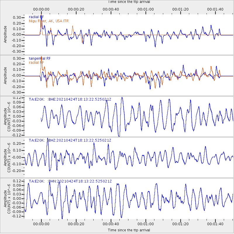
E20K Nigu River, AK, USA - Earthquake Result Viewer
*The percent match for this event was below the threshold and hence no stack was calculated.
| Earthquake location: |
Owen Fracture Zone Region |
| Earthquake latitude/longitude: |
13.8/57.1 |
| Earthquake time(UTC): |
2021/04/24 (114) 18:00:32 GMT |
| Earthquake Depth: |
10 km |
| Earthquake Magnitude: |
5.6 Mww |
| Earthquake Catalog/Contributor: |
NEIC PDE/us |
|
| Network: |
TA USArray Transportable Network (new EarthScope stations) |
| Station: |
E20K Nigu River, AK, USA |
| Lat/Lon: |
68.26 N/156.19 W |
| Elevation: |
866 m |
|
| Distance: |
94.7 deg |
| Az: |
11.844 deg |
| Baz: |
327.646 deg |
| Ray Param: |
$rayparam |
*The percent match for this event was below the threshold and hence was not used in the summary stack. |
|
| Radial Match: |
53.756237 % |
| Radial Bump: |
400 |
| Transverse Match: |
61.7421 % |
| Transverse Bump: |
389 |
| SOD ConfigId: |
24334971 |
| Insert Time: |
2021-05-08 18:08:18.924 +0000 |
| GWidth: |
2.5 |
| Max Bumps: |
400 |
| Tol: |
0.001 |
|
Signal To Noise
| Channel | StoN | STA | LTA |
| TA:E20K: :BHZ:20210424T18:13:22.525021Z | 1.797745 | 1.2343101E-7 | 6.86588E-8 |
| TA:E20K: :BHN:20210424T18:13:22.525021Z | 1.149224 | 5.616817E-8 | 4.8874867E-8 |
| TA:E20K: :BHE:20210424T18:13:22.525021Z | 0.8116177 | 3.384549E-8 | 4.1701274E-8 |
| Arrivals |
| Ps | |
| PpPs | |
| PsPs/PpSs | |


