
KDJ XW.KDJ - Earthquake Result Viewer
| ||||||||||||||||||
| ||||||||||||||||||
| ||||||||||||||||||
|
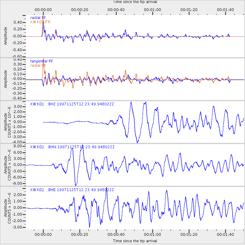
Signal To Noise
| Channel | StoN | STA | LTA |
| XW:KDJ: :BHN:19971125T12:23:49.948022Z | 0.7153925 | 9.746208E-8 | 1.3623583E-7 |
| XW:KDJ: :BHE:19971125T12:23:49.948022Z | 0.9688873 | 3.36049E-8 | 3.4684014E-8 |
| XW:KDJ: :BHZ:19971125T12:23:49.948022Z | 1.4497098 | 1.976693E-7 | 1.3635095E-7 |
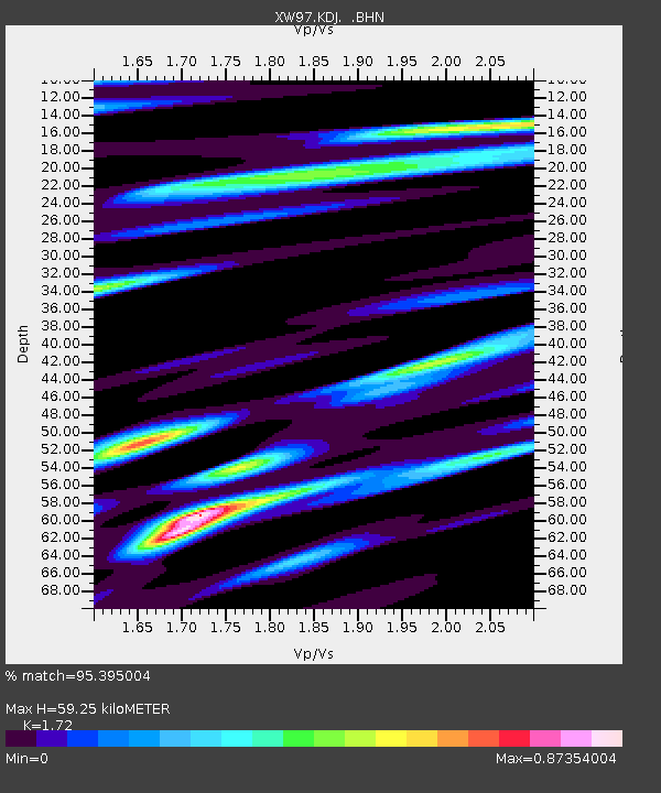
| Arrivals | |
| Ps | 7.1 SECOND |
| PpPs | 24 SECOND |
| PsPs/PpSs | 31 SECOND |

