You are here: Home > Network List > AV - Alaska Volcano Observatory Stations List
> Station MAPS Pakushin Southeast, Makushin Volcano, Alaska > Earthquake Result Viewer
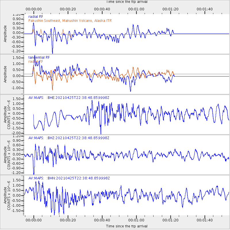
MAPS Pakushin Southeast, Makushin Volcano, Alaska - Earthquake Result Viewer
*The percent match for this event was below the threshold and hence no stack was calculated.
| Earthquake location: |
Fiji Islands Region |
| Earthquake latitude/longitude: |
-21.7/-177.1 |
| Earthquake time(UTC): |
2021/04/25 (115) 22:28:00 GMT |
| Earthquake Depth: |
234 km |
| Earthquake Magnitude: |
6.4 Mww |
| Earthquake Catalog/Contributor: |
NEIC PDE/us |
|
| Network: |
AV Alaska Volcano Observatory |
| Station: |
MAPS Pakushin Southeast, Makushin Volcano, Alaska |
| Lat/Lon: |
53.81 N/166.94 W |
| Elevation: |
333 m |
|
| Distance: |
75.7 deg |
| Az: |
6.176 deg |
| Baz: |
189.713 deg |
| Ray Param: |
$rayparam |
*The percent match for this event was below the threshold and hence was not used in the summary stack. |
|
| Radial Match: |
52.087967 % |
| Radial Bump: |
318 |
| Transverse Match: |
47.840527 % |
| Transverse Bump: |
304 |
| SOD ConfigId: |
24334971 |
| Insert Time: |
2021-05-09 22:38:54.701 +0000 |
| GWidth: |
2.5 |
| Max Bumps: |
400 |
| Tol: |
0.001 |
|
Signal To Noise
| Channel | StoN | STA | LTA |
| AV:MAPS: :BHZ:20210425T22:38:48.859998Z | 3.3254015 | 5.071967E-7 | 1.5252195E-7 |
| AV:MAPS: :BHN:20210425T22:38:48.859998Z | 1.389447 | 6.32088E-7 | 4.5492058E-7 |
| AV:MAPS: :BHE:20210425T22:38:48.859998Z | 1.6792607 | 8.9781855E-7 | 5.3465106E-7 |
| Arrivals |
| Ps | |
| PpPs | |
| PsPs/PpSs | |


