You are here: Home > Network List > GM - US Geological Survey Networks Stations List
> Station IWM01 Jericho 2M Well Monitoring Station > Earthquake Result Viewer
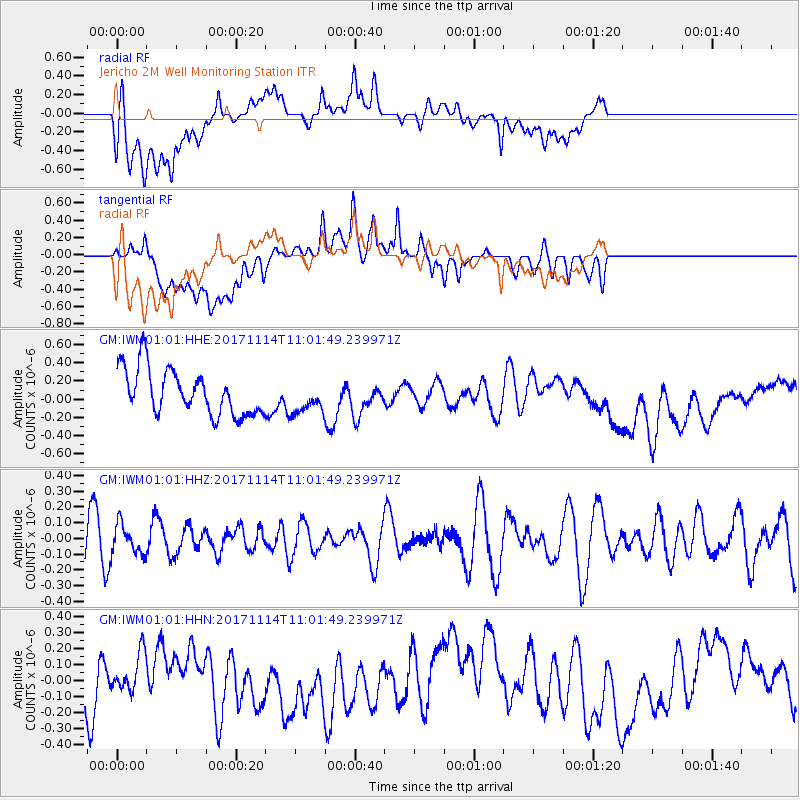
IWM01 Jericho 2M Well Monitoring Station - Earthquake Result Viewer
*The percent match for this event was below the threshold and hence no stack was calculated.
| Earthquake location: |
Fiji Islands Region |
| Earthquake latitude/longitude: |
-18.2/-178.0 |
| Earthquake time(UTC): |
2017/11/14 (318) 10:50:05 GMT |
| Earthquake Depth: |
604 km |
| Earthquake Magnitude: |
5.5 Mww |
| Earthquake Catalog/Contributor: |
NEIC PDE/us |
|
| Network: |
GM US Geological Survey Networks |
| Station: |
IWM01 Jericho 2M Well Monitoring Station |
| Lat/Lon: |
36.73 N/96.53 W |
| Elevation: |
328 m |
|
| Distance: |
94.1 deg |
| Az: |
52.797 deg |
| Baz: |
250.502 deg |
| Ray Param: |
$rayparam |
*The percent match for this event was below the threshold and hence was not used in the summary stack. |
|
| Radial Match: |
43.875984 % |
| Radial Bump: |
400 |
| Transverse Match: |
39.95888 % |
| Transverse Bump: |
400 |
| SOD ConfigId: |
2429771 |
| Insert Time: |
2017-11-28 10:51:01.138 +0000 |
| GWidth: |
2.5 |
| Max Bumps: |
400 |
| Tol: |
0.001 |
|
Signal To Noise
| Channel | StoN | STA | LTA |
| GM:IWM01:01:HHZ:20171114T11:01:49.239971Z | 0.81917626 | 9.2526676E-8 | 1.12950886E-7 |
| GM:IWM01:01:HHN:20171114T11:01:49.239971Z | 0.5724472 | 1.1632618E-7 | 2.0320857E-7 |
| GM:IWM01:01:HHE:20171114T11:01:49.239971Z | 0.7119511 | 1.7726487E-7 | 2.489846E-7 |
| Arrivals |
| Ps | |
| PpPs | |
| PsPs/PpSs | |


