You are here: Home > Network List > GS - US Geological Survey Networks Stations List
> Station OK031 S. Brethren Rd., Cushing, OK, USA > Earthquake Result Viewer
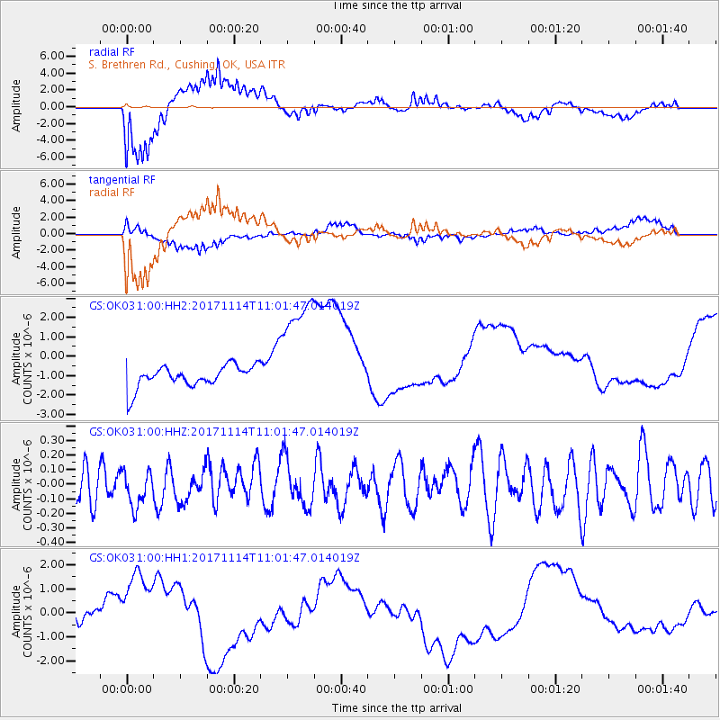
OK031 S. Brethren Rd., Cushing, OK, USA - Earthquake Result Viewer
*The percent match for this event was below the threshold and hence no stack was calculated.
| Earthquake location: |
Fiji Islands Region |
| Earthquake latitude/longitude: |
-18.2/-178.0 |
| Earthquake time(UTC): |
2017/11/14 (318) 10:50:05 GMT |
| Earthquake Depth: |
604 km |
| Earthquake Magnitude: |
5.5 Mww |
| Earthquake Catalog/Contributor: |
NEIC PDE/us |
|
| Network: |
GS US Geological Survey Networks |
| Station: |
OK031 S. Brethren Rd., Cushing, OK, USA |
| Lat/Lon: |
35.95 N/96.84 W |
| Elevation: |
290 m |
|
| Distance: |
93.6 deg |
| Az: |
53.443 deg |
| Baz: |
250.277 deg |
| Ray Param: |
$rayparam |
*The percent match for this event was below the threshold and hence was not used in the summary stack. |
|
| Radial Match: |
76.40807 % |
| Radial Bump: |
400 |
| Transverse Match: |
67.91234 % |
| Transverse Bump: |
400 |
| SOD ConfigId: |
2429771 |
| Insert Time: |
2017-11-28 10:51:18.973 +0000 |
| GWidth: |
2.5 |
| Max Bumps: |
400 |
| Tol: |
0.001 |
|
Signal To Noise
| Channel | StoN | STA | LTA |
| GS:OK031:00:HHZ:20171114T11:01:47.014019Z | 0.92083824 | 1.2261818E-7 | 1.331593E-7 |
| GS:OK031:00:HH1:20171114T11:01:47.014019Z | 1.8829726 | 1.3878671E-6 | 7.370617E-7 |
| GS:OK031:00:HH2:20171114T11:01:47.014019Z | 5.5016212 | 3.1234588E-6 | 5.677342E-7 |
| Arrivals |
| Ps | |
| PpPs | |
| PsPs/PpSs | |


