You are here: Home > Network List > US - United States National Seismic Network Stations List
> Station OGNE Ogallala, Nebraska, USA > Earthquake Result Viewer
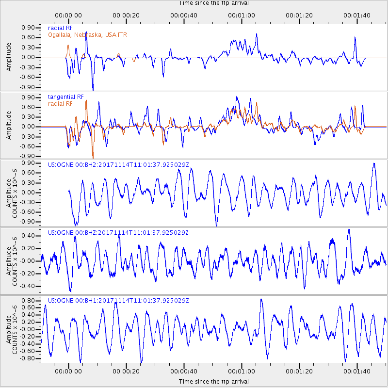
OGNE Ogallala, Nebraska, USA - Earthquake Result Viewer
*The percent match for this event was below the threshold and hence no stack was calculated.
| Earthquake location: |
Fiji Islands Region |
| Earthquake latitude/longitude: |
-18.2/-178.0 |
| Earthquake time(UTC): |
2017/11/14 (318) 10:50:05 GMT |
| Earthquake Depth: |
604 km |
| Earthquake Magnitude: |
5.5 Mww |
| Earthquake Catalog/Contributor: |
NEIC PDE/us |
|
| Network: |
US United States National Seismic Network |
| Station: |
OGNE Ogallala, Nebraska, USA |
| Lat/Lon: |
40.95 N/102.03 W |
| Elevation: |
1054 m |
|
| Distance: |
91.6 deg |
| Az: |
47.319 deg |
| Baz: |
247.332 deg |
| Ray Param: |
$rayparam |
*The percent match for this event was below the threshold and hence was not used in the summary stack. |
|
| Radial Match: |
60.087063 % |
| Radial Bump: |
400 |
| Transverse Match: |
45.541786 % |
| Transverse Bump: |
400 |
| SOD ConfigId: |
2429771 |
| Insert Time: |
2017-11-28 10:53:21.252 +0000 |
| GWidth: |
2.5 |
| Max Bumps: |
400 |
| Tol: |
0.001 |
|
Signal To Noise
| Channel | StoN | STA | LTA |
| US:OGNE:00:BHZ:20171114T11:01:37.925029Z | 1.711481 | 2.4865463E-7 | 1.4528624E-7 |
| US:OGNE:00:BH1:20171114T11:01:37.925029Z | 1.080367 | 4.4272224E-7 | 4.0978878E-7 |
| US:OGNE:00:BH2:20171114T11:01:37.925029Z | 0.81485075 | 3.1250076E-7 | 3.8350677E-7 |
| Arrivals |
| Ps | |
| PpPs | |
| PsPs/PpSs | |


