You are here: Home > Network List > GS - US Geological Survey Networks Stations List
> Station OK031 S. Brethren Rd., Cushing, OK, USA > Earthquake Result Viewer
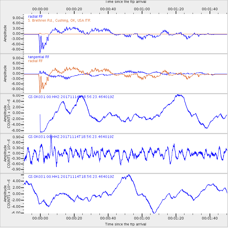
OK031 S. Brethren Rd., Cushing, OK, USA - Earthquake Result Viewer
*The percent match for this event was below the threshold and hence no stack was calculated.
| Earthquake location: |
Tonga Islands Region |
| Earthquake latitude/longitude: |
-18.6/-171.5 |
| Earthquake time(UTC): |
2017/11/14 (318) 18:44:00 GMT |
| Earthquake Depth: |
10 km |
| Earthquake Magnitude: |
5.4 Mww |
| Earthquake Catalog/Contributor: |
NEIC PDE/us |
|
| Network: |
GS US Geological Survey Networks |
| Station: |
OK031 S. Brethren Rd., Cushing, OK, USA |
| Lat/Lon: |
35.95 N/96.84 W |
| Elevation: |
290 m |
|
| Distance: |
89.0 deg |
| Az: |
51.503 deg |
| Baz: |
246.17 deg |
| Ray Param: |
$rayparam |
*The percent match for this event was below the threshold and hence was not used in the summary stack. |
|
| Radial Match: |
69.2676 % |
| Radial Bump: |
400 |
| Transverse Match: |
60.73819 % |
| Transverse Bump: |
400 |
| SOD ConfigId: |
2429771 |
| Insert Time: |
2017-11-28 18:45:23.023 +0000 |
| GWidth: |
2.5 |
| Max Bumps: |
400 |
| Tol: |
0.001 |
|
Signal To Noise
| Channel | StoN | STA | LTA |
| GS:OK031:00:HHZ:20171114T18:56:23.464019Z | 1.4569042 | 2.973198E-7 | 2.0407643E-7 |
| GS:OK031:00:HH1:20171114T18:56:23.464019Z | 2.331632 | 4.363069E-6 | 1.8712512E-6 |
| GS:OK031:00:HH2:20171114T18:56:23.464019Z | 0.5918755 | 2.130577E-6 | 3.5997048E-6 |
| Arrivals |
| Ps | |
| PpPs | |
| PsPs/PpSs | |


