You are here: Home > Network List > TA - USArray Transportable Network (new EarthScope stations) Stations List
> Station L15K Ungalak Mountain, AK, USA > Earthquake Result Viewer
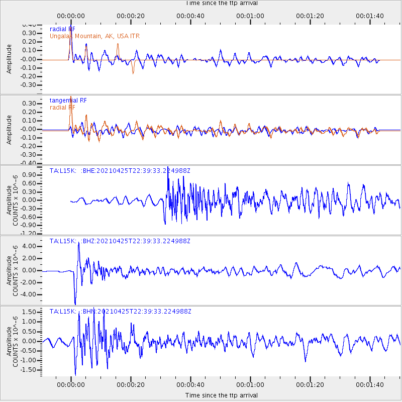
L15K Ungalak Mountain, AK, USA - Earthquake Result Viewer
*The percent match for this event was below the threshold and hence no stack was calculated.
| Earthquake location: |
Fiji Islands Region |
| Earthquake latitude/longitude: |
-21.7/-177.1 |
| Earthquake time(UTC): |
2021/04/25 (115) 22:28:00 GMT |
| Earthquake Depth: |
234 km |
| Earthquake Magnitude: |
6.4 Mww |
| Earthquake Catalog/Contributor: |
NEIC PDE/us |
|
| Network: |
TA USArray Transportable Network (new EarthScope stations) |
| Station: |
L15K Ungalak Mountain, AK, USA |
| Lat/Lon: |
61.68 N/161.49 W |
| Elevation: |
219 m |
|
| Distance: |
84.0 deg |
| Az: |
7.398 deg |
| Baz: |
194.544 deg |
| Ray Param: |
$rayparam |
*The percent match for this event was below the threshold and hence was not used in the summary stack. |
|
| Radial Match: |
79.63515 % |
| Radial Bump: |
355 |
| Transverse Match: |
70.72395 % |
| Transverse Bump: |
400 |
| SOD ConfigId: |
24334971 |
| Insert Time: |
2021-05-09 22:57:17.574 +0000 |
| GWidth: |
2.5 |
| Max Bumps: |
400 |
| Tol: |
0.001 |
|
Signal To Noise
| Channel | StoN | STA | LTA |
| TA:L15K: :BHZ:20210425T22:39:33.224988Z | 19.562561 | 2.145292E-6 | 1.0966314E-7 |
| TA:L15K: :BHN:20210425T22:39:33.224988Z | 6.982263 | 6.759536E-7 | 9.68101E-8 |
| TA:L15K: :BHE:20210425T22:39:33.224988Z | 5.2833977 | 4.032185E-7 | 7.631803E-8 |
| Arrivals |
| Ps | |
| PpPs | |
| PsPs/PpSs | |


