You are here: Home > Network List > US - United States National Seismic Network Stations List
> Station WUAZ Wupatki, Arizona, USA > Earthquake Result Viewer
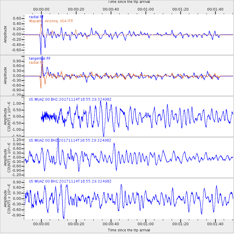
WUAZ Wupatki, Arizona, USA - Earthquake Result Viewer
*The percent match for this event was below the threshold and hence no stack was calculated.
| Earthquake location: |
Tonga Islands Region |
| Earthquake latitude/longitude: |
-18.6/-171.5 |
| Earthquake time(UTC): |
2017/11/14 (318) 18:44:00 GMT |
| Earthquake Depth: |
10 km |
| Earthquake Magnitude: |
5.4 Mww |
| Earthquake Catalog/Contributor: |
NEIC PDE/us |
|
| Network: |
US United States National Seismic Network |
| Station: |
WUAZ Wupatki, Arizona, USA |
| Lat/Lon: |
35.52 N/111.37 W |
| Elevation: |
1592 m |
|
| Distance: |
78.4 deg |
| Az: |
46.246 deg |
| Baz: |
237.106 deg |
| Ray Param: |
$rayparam |
*The percent match for this event was below the threshold and hence was not used in the summary stack. |
|
| Radial Match: |
69.95736 % |
| Radial Bump: |
400 |
| Transverse Match: |
69.52868 % |
| Transverse Bump: |
400 |
| SOD ConfigId: |
2429771 |
| Insert Time: |
2017-11-28 18:47:42.884 +0000 |
| GWidth: |
2.5 |
| Max Bumps: |
400 |
| Tol: |
0.001 |
|
Signal To Noise
| Channel | StoN | STA | LTA |
| US:WUAZ:00:BHZ:20171114T18:55:29.32498Z | 1.4680138 | 4.581819E-7 | 3.1211007E-7 |
| US:WUAZ:00:BH1:20171114T18:55:29.32498Z | 1.2222285 | 3.8181176E-7 | 3.123898E-7 |
| US:WUAZ:00:BH2:20171114T18:55:29.32498Z | 1.8174366 | 6.260319E-7 | 3.4445875E-7 |
| Arrivals |
| Ps | |
| PpPs | |
| PsPs/PpSs | |


