You are here: Home > Network List > WY - Yellowstone Wyoming Seismic Network Stations List
> Station YHR Hawk's Rest, WY, USA > Earthquake Result Viewer
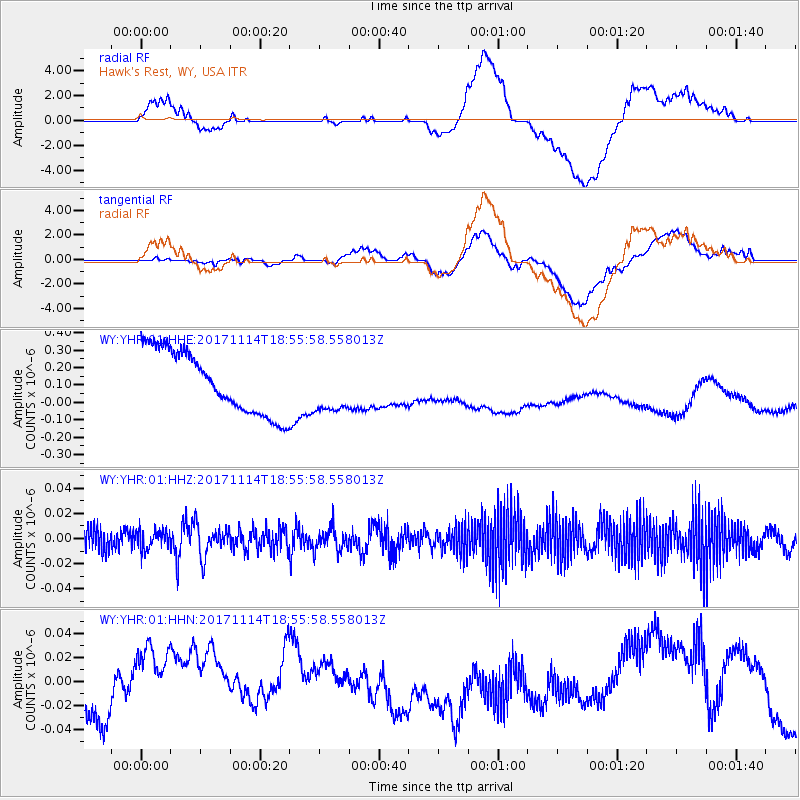
YHR Hawk's Rest, WY, USA - Earthquake Result Viewer
*The percent match for this event was below the threshold and hence no stack was calculated.
| Earthquake location: |
Tonga Islands Region |
| Earthquake latitude/longitude: |
-18.6/-171.5 |
| Earthquake time(UTC): |
2017/11/14 (318) 18:44:00 GMT |
| Earthquake Depth: |
10 km |
| Earthquake Magnitude: |
5.4 Mww |
| Earthquake Catalog/Contributor: |
NEIC PDE/us |
|
| Network: |
WY Yellowstone Wyoming Seismic Network |
| Station: |
YHR Hawk's Rest, WY, USA |
| Lat/Lon: |
44.11 N/110.08 W |
| Elevation: |
2976 m |
|
| Distance: |
83.9 deg |
| Az: |
39.517 deg |
| Baz: |
236.891 deg |
| Ray Param: |
$rayparam |
*The percent match for this event was below the threshold and hence was not used in the summary stack. |
|
| Radial Match: |
20.790619 % |
| Radial Bump: |
400 |
| Transverse Match: |
15.598283 % |
| Transverse Bump: |
400 |
| SOD ConfigId: |
2429771 |
| Insert Time: |
2017-11-28 18:48:16.562 +0000 |
| GWidth: |
2.5 |
| Max Bumps: |
400 |
| Tol: |
0.001 |
|
Signal To Noise
| Channel | StoN | STA | LTA |
| WY:YHR:01:HHZ:20171114T18:55:58.558013Z | 0.42797977 | 7.583186E-9 | 1.771856E-8 |
| WY:YHR:01:HHN:20171114T18:55:58.558013Z | 1.9510874 | 3.9967E-8 | 2.0484473E-8 |
| WY:YHR:01:HHE:20171114T18:55:58.558013Z | 0.8214532 | 1.4719726E-7 | 1.7919129E-7 |
| Arrivals |
| Ps | |
| PpPs | |
| PsPs/PpSs | |


