You are here: Home > Network List > G - GEOSCOPE Stations List
> Station NOUC Port Laguerre, New Caledonia > Earthquake Result Viewer
NOUC Port Laguerre, New Caledonia - Earthquake Result Viewer
*The percent match for this event was below the threshold and hence no stack was calculated.
| Earthquake location: |
South Of Mariana Islands |
| Earthquake latitude/longitude: |
13.1/143.7 |
| Earthquake time(UTC): |
2017/11/15 (319) 00:24:32 GMT |
| Earthquake Depth: |
123 km |
| Earthquake Magnitude: |
5.8 Mww |
| Earthquake Catalog/Contributor: |
NEIC PDE/us |
|
| Network: |
G GEOSCOPE |
| Station: |
NOUC Port Laguerre, New Caledonia |
| Lat/Lon: |
22.10 S/166.30 E |
| Elevation: |
112 m |
|
| Distance: |
41.4 deg |
| Az: |
147.333 deg |
| Baz: |
325.449 deg |
| Ray Param: |
$rayparam |
*The percent match for this event was below the threshold and hence was not used in the summary stack. |
|
| Radial Match: |
63.777523 % |
| Radial Bump: |
400 |
| Transverse Match: |
55.085278 % |
| Transverse Bump: |
400 |
| SOD ConfigId: |
2429771 |
| Insert Time: |
2017-11-29 00:25:16.480 +0000 |
| GWidth: |
2.5 |
| Max Bumps: |
400 |
| Tol: |
0.001 |
|
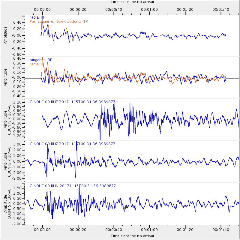
Signal To Noise
| Channel | StoN | STA | LTA |
| G:NOUC:00:BHZ:20171115T00:31:36.398987Z | 3.989962 | 1.1627077E-6 | 2.9140818E-7 |
| G:NOUC:00:BHN:20171115T00:31:36.398987Z | 3.0912154 | 5.6210826E-7 | 1.8184053E-7 |
| G:NOUC:00:BHE:20171115T00:31:36.398987Z | 1.6647888 | 5.145575E-7 | 3.0908274E-7 |
| Arrivals |
| Ps | |
| PpPs | |
| PsPs/PpSs | |


