You are here: Home > Network List > US - United States National Seismic Network Stations List
> Station DGMT Dagmar, Montana, USA > Earthquake Result Viewer
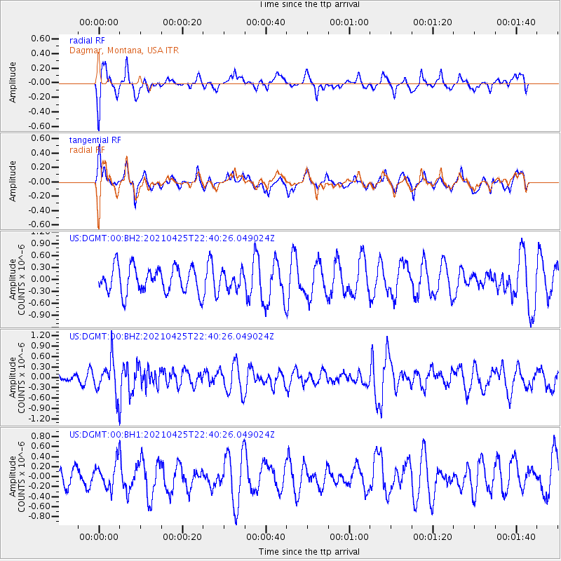
DGMT Dagmar, Montana, USA - Earthquake Result Viewer
*The percent match for this event was below the threshold and hence no stack was calculated.
| Earthquake location: |
Fiji Islands Region |
| Earthquake latitude/longitude: |
-21.7/-177.1 |
| Earthquake time(UTC): |
2021/04/25 (115) 22:28:00 GMT |
| Earthquake Depth: |
234 km |
| Earthquake Magnitude: |
6.4 Mww |
| Earthquake Catalog/Contributor: |
NEIC PDE/us |
|
| Network: |
US United States National Seismic Network |
| Station: |
DGMT Dagmar, Montana, USA |
| Lat/Lon: |
48.47 N/104.20 W |
| Elevation: |
0.0 m |
|
| Distance: |
95.3 deg |
| Az: |
39.693 deg |
| Baz: |
243.2 deg |
| Ray Param: |
$rayparam |
*The percent match for this event was below the threshold and hence was not used in the summary stack. |
|
| Radial Match: |
58.446857 % |
| Radial Bump: |
400 |
| Transverse Match: |
44.837223 % |
| Transverse Bump: |
400 |
| SOD ConfigId: |
24334971 |
| Insert Time: |
2021-05-09 23:01:29.603 +0000 |
| GWidth: |
2.5 |
| Max Bumps: |
400 |
| Tol: |
0.001 |
|
Signal To Noise
| Channel | StoN | STA | LTA |
| US:DGMT:00:BHZ:20210425T22:40:26.049024Z | 3.4909585 | 5.097347E-7 | 1.460157E-7 |
| US:DGMT:00:BH1:20210425T22:40:26.049024Z | 0.91192466 | 2.6371936E-7 | 2.8918987E-7 |
| US:DGMT:00:BH2:20210425T22:40:26.049024Z | 0.63548744 | 2.0753016E-7 | 3.265685E-7 |
| Arrivals |
| Ps | |
| PpPs | |
| PsPs/PpSs | |


