You are here: Home > Network List > UW - Pacific Northwest Regional Seismic Network Stations List
> Station HOOD Mt Hood Meadows, OR CREST BB SMO > Earthquake Result Viewer
HOOD Mt Hood Meadows, OR CREST BB SMO - Earthquake Result Viewer
*The percent match for this event was below the threshold and hence no stack was calculated.
| Earthquake location: |
Fiji Islands Region |
| Earthquake latitude/longitude: |
-21.7/-177.1 |
| Earthquake time(UTC): |
2021/04/25 (115) 22:28:00 GMT |
| Earthquake Depth: |
234 km |
| Earthquake Magnitude: |
6.4 Mww |
| Earthquake Catalog/Contributor: |
NEIC PDE/us |
|
| Network: |
UW Pacific Northwest Regional Seismic Network |
| Station: |
HOOD Mt Hood Meadows, OR CREST BB SMO |
| Lat/Lon: |
45.32 N/121.65 W |
| Elevation: |
1520 m |
|
| Distance: |
83.6 deg |
| Az: |
35.767 deg |
| Baz: |
230.402 deg |
| Ray Param: |
$rayparam |
*The percent match for this event was below the threshold and hence was not used in the summary stack. |
|
| Radial Match: |
59.1859 % |
| Radial Bump: |
400 |
| Transverse Match: |
59.23428 % |
| Transverse Bump: |
400 |
| SOD ConfigId: |
24334971 |
| Insert Time: |
2021-05-09 23:03:31.549 +0000 |
| GWidth: |
2.5 |
| Max Bumps: |
400 |
| Tol: |
0.001 |
|
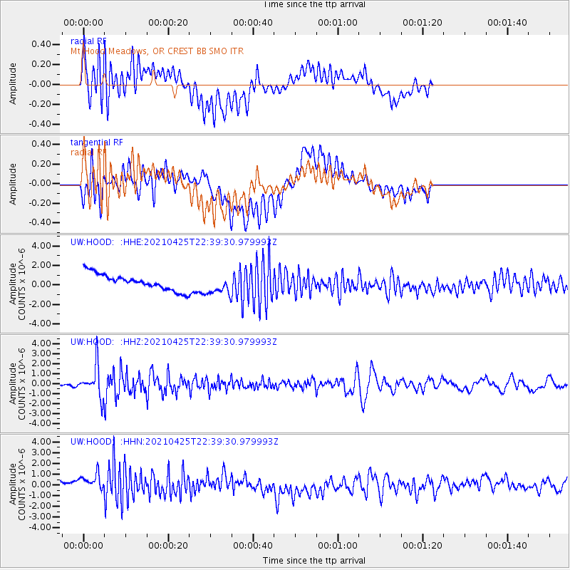
Signal To Noise
| Channel | StoN | STA | LTA |
| UW:HOOD: :HHZ:20210425T22:39:30.979993Z | 15.9499 | 1.5871766E-6 | 9.951013E-8 |
| UW:HOOD: :HHN:20210425T22:39:30.979993Z | 2.6187212 | 8.75898E-7 | 3.344755E-7 |
| UW:HOOD: :HHE:20210425T22:39:30.979993Z | 1.2375925 | 1.0088036E-6 | 8.1513394E-7 |
| Arrivals |
| Ps | |
| PpPs | |
| PsPs/PpSs | |


