You are here: Home > Network List > IU - Global Seismograph Network (GSN - IRIS/USGS) Stations List
> Station RSSD Black Hills, South Dakota, USA > Earthquake Result Viewer
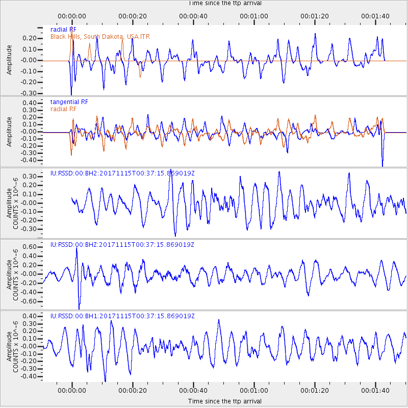
RSSD Black Hills, South Dakota, USA - Earthquake Result Viewer
*The percent match for this event was below the threshold and hence no stack was calculated.
| Earthquake location: |
South Of Mariana Islands |
| Earthquake latitude/longitude: |
13.1/143.7 |
| Earthquake time(UTC): |
2017/11/15 (319) 00:24:32 GMT |
| Earthquake Depth: |
123 km |
| Earthquake Magnitude: |
5.8 Mww |
| Earthquake Catalog/Contributor: |
NEIC PDE/us |
|
| Network: |
IU Global Seismograph Network (GSN - IRIS/USGS) |
| Station: |
RSSD Black Hills, South Dakota, USA |
| Lat/Lon: |
44.12 N/104.04 W |
| Elevation: |
2090 m |
|
| Distance: |
96.3 deg |
| Az: |
42.1 deg |
| Baz: |
294.895 deg |
| Ray Param: |
$rayparam |
*The percent match for this event was below the threshold and hence was not used in the summary stack. |
|
| Radial Match: |
52.68216 % |
| Radial Bump: |
400 |
| Transverse Match: |
57.683834 % |
| Transverse Bump: |
400 |
| SOD ConfigId: |
2429771 |
| Insert Time: |
2017-11-29 00:26:04.052 +0000 |
| GWidth: |
2.5 |
| Max Bumps: |
400 |
| Tol: |
0.001 |
|
Signal To Noise
| Channel | StoN | STA | LTA |
| IU:RSSD:00:BHZ:20171115T00:37:15.869019Z | 2.4932325 | 2.966966E-7 | 1.19000774E-7 |
| IU:RSSD:00:BH1:20171115T00:37:15.869019Z | 1.3132643 | 1.638642E-7 | 1.2477626E-7 |
| IU:RSSD:00:BH2:20171115T00:37:15.869019Z | 1.8812366 | 2.0426367E-7 | 1.0857947E-7 |
| Arrivals |
| Ps | |
| PpPs | |
| PsPs/PpSs | |


