You are here: Home > Network List > IW - Intermountain West Stations List
> Station MOOW Moose Ponds, Wyoming, USA > Earthquake Result Viewer
MOOW Moose Ponds, Wyoming, USA - Earthquake Result Viewer
*The percent match for this event was below the threshold and hence no stack was calculated.
| Earthquake location: |
South Of Mariana Islands |
| Earthquake latitude/longitude: |
13.1/143.7 |
| Earthquake time(UTC): |
2017/11/15 (319) 00:24:32 GMT |
| Earthquake Depth: |
123 km |
| Earthquake Magnitude: |
5.8 Mww |
| Earthquake Catalog/Contributor: |
NEIC PDE/us |
|
| Network: |
IW Intermountain West |
| Station: |
MOOW Moose Ponds, Wyoming, USA |
| Lat/Lon: |
43.75 N/110.74 W |
| Elevation: |
2128 m |
|
| Distance: |
92.0 deg |
| Az: |
44.303 deg |
| Baz: |
290.093 deg |
| Ray Param: |
$rayparam |
*The percent match for this event was below the threshold and hence was not used in the summary stack. |
|
| Radial Match: |
54.772774 % |
| Radial Bump: |
400 |
| Transverse Match: |
51.958363 % |
| Transverse Bump: |
400 |
| SOD ConfigId: |
2429771 |
| Insert Time: |
2017-11-29 00:26:22.341 +0000 |
| GWidth: |
2.5 |
| Max Bumps: |
400 |
| Tol: |
0.001 |
|
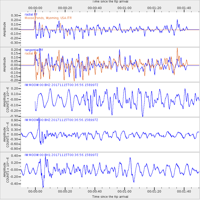
Signal To Noise
| Channel | StoN | STA | LTA |
| IW:MOOW:00:BHZ:20171115T00:36:56.158997Z | 2.893032 | 3.9254542E-7 | 1.356865E-7 |
| IW:MOOW:00:BH1:20171115T00:36:56.158997Z | 2.1733286 | 1.5667622E-7 | 7.2090444E-8 |
| IW:MOOW:00:BH2:20171115T00:36:56.158997Z | 0.7210009 | 7.526755E-8 | 1.0439315E-7 |
| Arrivals |
| Ps | |
| PpPs | |
| PsPs/PpSs | |


