You are here: Home > Network List > US - United States National Seismic Network Stations List
> Station MIAR Mount Ida, Arkansas, USA > Earthquake Result Viewer
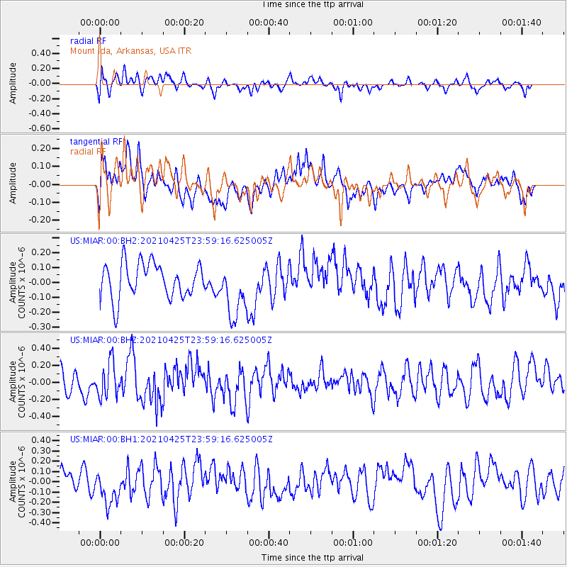
MIAR Mount Ida, Arkansas, USA - Earthquake Result Viewer
*The percent match for this event was below the threshold and hence no stack was calculated.
| Earthquake location: |
Near Coast Of Peru |
| Earthquake latitude/longitude: |
-15.6/-74.6 |
| Earthquake time(UTC): |
2021/04/25 (115) 23:50:30 GMT |
| Earthquake Depth: |
13 km |
| Earthquake Magnitude: |
5.5 mww |
| Earthquake Catalog/Contributor: |
NEIC PDE/us |
|
| Network: |
US United States National Seismic Network |
| Station: |
MIAR Mount Ida, Arkansas, USA |
| Lat/Lon: |
34.55 N/93.58 W |
| Elevation: |
207 m |
|
| Distance: |
53.0 deg |
| Az: |
340.338 deg |
| Baz: |
156.871 deg |
| Ray Param: |
$rayparam |
*The percent match for this event was below the threshold and hence was not used in the summary stack. |
|
| Radial Match: |
44.44247 % |
| Radial Bump: |
400 |
| Transverse Match: |
54.427387 % |
| Transverse Bump: |
400 |
| SOD ConfigId: |
24334971 |
| Insert Time: |
2021-05-10 00:10:27.715 +0000 |
| GWidth: |
2.5 |
| Max Bumps: |
400 |
| Tol: |
0.001 |
|
Signal To Noise
| Channel | StoN | STA | LTA |
| US:MIAR:00:BHZ:20210425T23:59:16.625005Z | 1.0730242 | 2.0490623E-7 | 1.9096144E-7 |
| US:MIAR:00:BH1:20210425T23:59:16.625005Z | 1.148362 | 1.7407699E-7 | 1.515872E-7 |
| US:MIAR:00:BH2:20210425T23:59:16.625005Z | 1.6295003 | 1.9167464E-7 | 1.1762787E-7 |
| Arrivals |
| Ps | |
| PpPs | |
| PsPs/PpSs | |


