You are here: Home > Network List > CI - Caltech Regional Seismic Network Stations List
> Station MPM Manuel Prospect Mine, California, USA > Earthquake Result Viewer
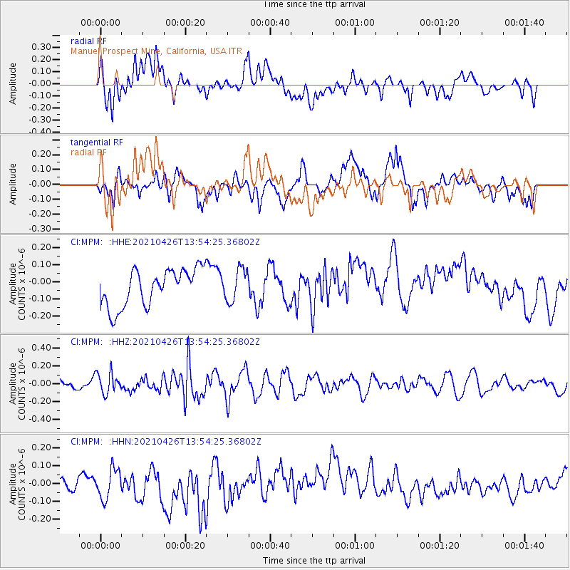
MPM Manuel Prospect Mine, California, USA - Earthquake Result Viewer
*The percent match for this event was below the threshold and hence no stack was calculated.
| Earthquake location: |
Kermadec Islands, New Zealand |
| Earthquake latitude/longitude: |
-29.2/-177.6 |
| Earthquake time(UTC): |
2021/04/26 (116) 13:42:22 GMT |
| Earthquake Depth: |
60 km |
| Earthquake Magnitude: |
5.5 mb |
| Earthquake Catalog/Contributor: |
NEIC PDE/us |
|
| Network: |
CI Caltech Regional Seismic Network |
| Station: |
MPM Manuel Prospect Mine, California, USA |
| Lat/Lon: |
36.06 N/117.49 W |
| Elevation: |
185 m |
|
| Distance: |
86.1 deg |
| Az: |
44.752 deg |
| Baz: |
229.419 deg |
| Ray Param: |
$rayparam |
*The percent match for this event was below the threshold and hence was not used in the summary stack. |
|
| Radial Match: |
38.224396 % |
| Radial Bump: |
400 |
| Transverse Match: |
32.41658 % |
| Transverse Bump: |
400 |
| SOD ConfigId: |
24334971 |
| Insert Time: |
2021-05-10 13:49:42.765 +0000 |
| GWidth: |
2.5 |
| Max Bumps: |
400 |
| Tol: |
0.001 |
|
Signal To Noise
| Channel | StoN | STA | LTA |
| CI:MPM: :HHZ:20210426T13:54:25.36802Z | 1.8782153 | 1.1326492E-7 | 6.0304544E-8 |
| CI:MPM: :HHN:20210426T13:54:25.36802Z | 1.0949845 | 1.015174E-7 | 9.271126E-8 |
| CI:MPM: :HHE:20210426T13:54:25.36802Z | 0.8966505 | 9.587511E-8 | 1.06925846E-7 |
| Arrivals |
| Ps | |
| PpPs | |
| PsPs/PpSs | |


