You are here: Home > Network List > US - United States National Seismic Network Stations List
> Station EGMT Eagleton, Montana, USA > Earthquake Result Viewer
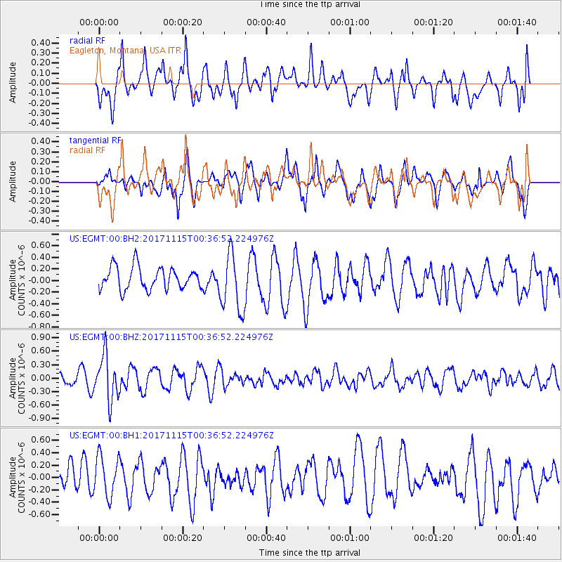
EGMT Eagleton, Montana, USA - Earthquake Result Viewer
*The percent match for this event was below the threshold and hence no stack was calculated.
| Earthquake location: |
South Of Mariana Islands |
| Earthquake latitude/longitude: |
13.1/143.7 |
| Earthquake time(UTC): |
2017/11/15 (319) 00:24:32 GMT |
| Earthquake Depth: |
123 km |
| Earthquake Magnitude: |
5.8 Mww |
| Earthquake Catalog/Contributor: |
NEIC PDE/us |
|
| Network: |
US United States National Seismic Network |
| Station: |
EGMT Eagleton, Montana, USA |
| Lat/Lon: |
48.02 N/109.75 W |
| Elevation: |
1055 m |
|
| Distance: |
91.2 deg |
| Az: |
40.054 deg |
| Baz: |
290.919 deg |
| Ray Param: |
$rayparam |
*The percent match for this event was below the threshold and hence was not used in the summary stack. |
|
| Radial Match: |
46.27429 % |
| Radial Bump: |
400 |
| Transverse Match: |
66.090965 % |
| Transverse Bump: |
400 |
| SOD ConfigId: |
2429771 |
| Insert Time: |
2017-11-29 00:27:29.779 +0000 |
| GWidth: |
2.5 |
| Max Bumps: |
400 |
| Tol: |
0.001 |
|
Signal To Noise
| Channel | StoN | STA | LTA |
| US:EGMT:00:BHZ:20171115T00:36:52.224976Z | 2.7436728 | 5.126429E-7 | 1.8684548E-7 |
| US:EGMT:00:BH1:20171115T00:36:52.224976Z | 1.161269 | 3.3329636E-7 | 2.870105E-7 |
| US:EGMT:00:BH2:20171115T00:36:52.224976Z | 2.640331 | 5.0727317E-7 | 1.9212484E-7 |
| Arrivals |
| Ps | |
| PpPs | |
| PsPs/PpSs | |


