You are here: Home > Network List > CI - Caltech Regional Seismic Network Stations List
> Station MPM Manuel Prospect Mine, California, USA > Earthquake Result Viewer
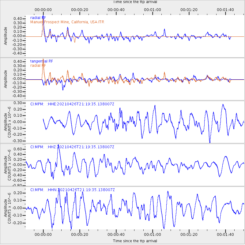
MPM Manuel Prospect Mine, California, USA - Earthquake Result Viewer
*The percent match for this event was below the threshold and hence no stack was calculated.
| Earthquake location: |
Kermadec Islands Region |
| Earthquake latitude/longitude: |
-29.3/-176.7 |
| Earthquake time(UTC): |
2021/04/26 (116) 21:07:28 GMT |
| Earthquake Depth: |
10 km |
| Earthquake Magnitude: |
5.8 mww |
| Earthquake Catalog/Contributor: |
NEIC PDE/us |
|
| Network: |
CI Caltech Regional Seismic Network |
| Station: |
MPM Manuel Prospect Mine, California, USA |
| Lat/Lon: |
36.06 N/117.49 W |
| Elevation: |
185 m |
|
| Distance: |
85.6 deg |
| Az: |
44.279 deg |
| Baz: |
228.83 deg |
| Ray Param: |
$rayparam |
*The percent match for this event was below the threshold and hence was not used in the summary stack. |
|
| Radial Match: |
69.18676 % |
| Radial Bump: |
400 |
| Transverse Match: |
60.365963 % |
| Transverse Bump: |
400 |
| SOD ConfigId: |
24334971 |
| Insert Time: |
2021-05-10 21:15:53.016 +0000 |
| GWidth: |
2.5 |
| Max Bumps: |
400 |
| Tol: |
0.001 |
|
Signal To Noise
| Channel | StoN | STA | LTA |
| CI:MPM: :HHZ:20210426T21:19:35.138007Z | 2.0901406 | 2.0154704E-7 | 9.6427506E-8 |
| CI:MPM: :HHN:20210426T21:19:35.138007Z | 1.709379 | 9.7611576E-8 | 5.710353E-8 |
| CI:MPM: :HHE:20210426T21:19:35.138007Z | 1.3024743 | 9.6903385E-8 | 7.439946E-8 |
| Arrivals |
| Ps | |
| PpPs | |
| PsPs/PpSs | |


