You are here: Home > Network List > CI - Caltech Regional Seismic Network Stations List
> Station MUR Murrieta > Earthquake Result Viewer
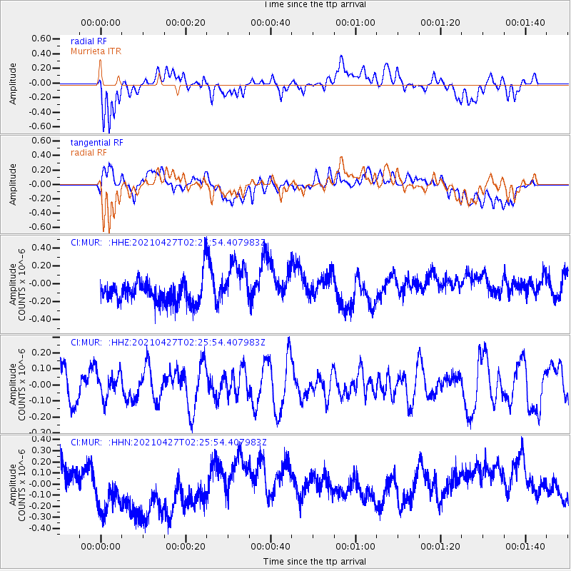
MUR Murrieta - Earthquake Result Viewer
*The percent match for this event was below the threshold and hence no stack was calculated.
| Earthquake location: |
Near N Coast Of New Guinea, P.N.G. |
| Earthquake latitude/longitude: |
-3.4/145.5 |
| Earthquake time(UTC): |
2021/04/27 (117) 02:12:50 GMT |
| Earthquake Depth: |
10 km |
| Earthquake Magnitude: |
5.7 mww |
| Earthquake Catalog/Contributor: |
NEIC PDE/us |
|
| Network: |
CI Caltech Regional Seismic Network |
| Station: |
MUR Murrieta |
| Lat/Lon: |
33.60 N/117.20 W |
| Elevation: |
562 m |
|
| Distance: |
97.9 deg |
| Az: |
56.71 deg |
| Baz: |
271.185 deg |
| Ray Param: |
$rayparam |
*The percent match for this event was below the threshold and hence was not used in the summary stack. |
|
| Radial Match: |
40.99257 % |
| Radial Bump: |
400 |
| Transverse Match: |
17.677916 % |
| Transverse Bump: |
400 |
| SOD ConfigId: |
24334971 |
| Insert Time: |
2021-05-11 02:20:11.812 +0000 |
| GWidth: |
2.5 |
| Max Bumps: |
400 |
| Tol: |
0.001 |
|
Signal To Noise
| Channel | StoN | STA | LTA |
| CI:MUR: :HHZ:20210427T02:25:54.407983Z | 0.5928264 | 7.690065E-8 | 1.2971866E-7 |
| CI:MUR: :HHN:20210427T02:25:54.407983Z | 2.3211598 | 3.466995E-7 | 1.4936477E-7 |
| CI:MUR: :HHE:20210427T02:25:54.407983Z | 1.9303921 | 2.5716798E-7 | 1.332206E-7 |
| Arrivals |
| Ps | |
| PpPs | |
| PsPs/PpSs | |


