You are here: Home > Network List > CI - Caltech Regional Seismic Network Stations List
> Station MPM Manuel Prospect Mine, California, USA > Earthquake Result Viewer
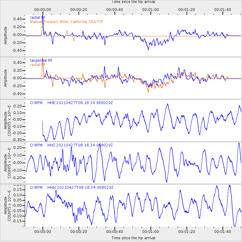
MPM Manuel Prospect Mine, California, USA - Earthquake Result Viewer
*The percent match for this event was below the threshold and hence no stack was calculated.
| Earthquake location: |
Near N Coast Of New Guinea, P.N.G. |
| Earthquake latitude/longitude: |
-3.4/145.5 |
| Earthquake time(UTC): |
2021/04/27 (117) 08:05:31 GMT |
| Earthquake Depth: |
10 km |
| Earthquake Magnitude: |
5.9 mww |
| Earthquake Catalog/Contributor: |
NEIC PDE/us |
|
| Network: |
CI Caltech Regional Seismic Network |
| Station: |
MPM Manuel Prospect Mine, California, USA |
| Lat/Lon: |
36.06 N/117.49 W |
| Elevation: |
185 m |
|
| Distance: |
97.7 deg |
| Az: |
54.242 deg |
| Baz: |
271.363 deg |
| Ray Param: |
$rayparam |
*The percent match for this event was below the threshold and hence was not used in the summary stack. |
|
| Radial Match: |
32.31288 % |
| Radial Bump: |
400 |
| Transverse Match: |
42.036766 % |
| Transverse Bump: |
400 |
| SOD ConfigId: |
24334971 |
| Insert Time: |
2021-05-11 08:12:33.377 +0000 |
| GWidth: |
2.5 |
| Max Bumps: |
400 |
| Tol: |
0.001 |
|
Signal To Noise
| Channel | StoN | STA | LTA |
| CI:MPM: :HHZ:20210427T08:18:34.968029Z | 0.6898888 | 7.1437576E-8 | 1.0354941E-7 |
| CI:MPM: :HHN:20210427T08:18:34.968029Z | 0.8902167 | 7.479354E-8 | 8.401722E-8 |
| CI:MPM: :HHE:20210427T08:18:34.968029Z | 1.299626 | 1.5077498E-7 | 1.1601413E-7 |
| Arrivals |
| Ps | |
| PpPs | |
| PsPs/PpSs | |


