You are here: Home > Network List > G - GEOSCOPE Stations List
> Station KIP Kipapa, Hawai, U.S.A. (Pacific Ocean) > Earthquake Result Viewer
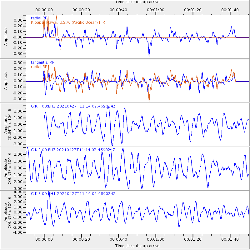
KIP Kipapa, Hawai, U.S.A. (Pacific Ocean) - Earthquake Result Viewer
*The percent match for this event was below the threshold and hence no stack was calculated.
| Earthquake location: |
Near N Coast Of New Guinea, P.N.G. |
| Earthquake latitude/longitude: |
-3.4/145.7 |
| Earthquake time(UTC): |
2021/04/27 (117) 11:04:24 GMT |
| Earthquake Depth: |
10 km |
| Earthquake Magnitude: |
5.5 mww |
| Earthquake Catalog/Contributor: |
NEIC PDE/us |
|
| Network: |
G GEOSCOPE |
| Station: |
KIP Kipapa, Hawai, U.S.A. (Pacific Ocean) |
| Lat/Lon: |
21.42 N/158.01 W |
| Elevation: |
70 m |
|
| Distance: |
60.4 deg |
| Az: |
63.123 deg |
| Baz: |
252.875 deg |
| Ray Param: |
$rayparam |
*The percent match for this event was below the threshold and hence was not used in the summary stack. |
|
| Radial Match: |
38.24579 % |
| Radial Bump: |
400 |
| Transverse Match: |
45.27827 % |
| Transverse Bump: |
400 |
| SOD ConfigId: |
24334971 |
| Insert Time: |
2021-05-11 11:11:20.087 +0000 |
| GWidth: |
2.5 |
| Max Bumps: |
400 |
| Tol: |
0.001 |
|
Signal To Noise
| Channel | StoN | STA | LTA |
| G:KIP:00:BHZ:20210427T11:14:02.469024Z | 1.0699015 | 1.2402897E-6 | 1.159256E-6 |
| G:KIP:00:BH1:20210427T11:14:02.469024Z | 2.5775342 | 2.2124116E-6 | 8.583442E-7 |
| G:KIP:00:BH2:20210427T11:14:02.469024Z | 1.6404561 | 1.7614428E-6 | 1.073752E-6 |
| Arrivals |
| Ps | |
| PpPs | |
| PsPs/PpSs | |


