You are here: Home > Network List > AV - Alaska Volcano Observatory Stations List
> Station MAPS Pakushin Southeast, Makushin Volcano, Alaska > Earthquake Result Viewer
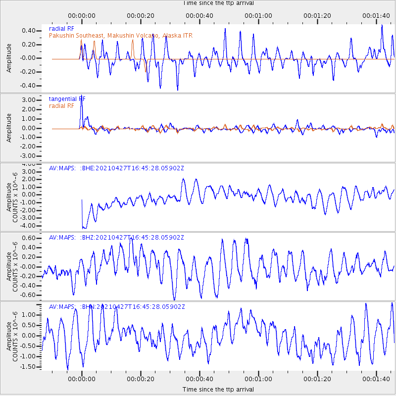
MAPS Pakushin Southeast, Makushin Volcano, Alaska - Earthquake Result Viewer
*The percent match for this event was below the threshold and hence no stack was calculated.
| Earthquake location: |
Kermadec Islands Region |
| Earthquake latitude/longitude: |
-29.2/-176.8 |
| Earthquake time(UTC): |
2021/04/27 (117) 16:33:33 GMT |
| Earthquake Depth: |
10 km |
| Earthquake Magnitude: |
5.9 mww |
| Earthquake Catalog/Contributor: |
NEIC PDE/us |
|
| Network: |
AV Alaska Volcano Observatory |
| Station: |
MAPS Pakushin Southeast, Makushin Volcano, Alaska |
| Lat/Lon: |
53.81 N/166.94 W |
| Elevation: |
333 m |
|
| Distance: |
83.1 deg |
| Az: |
5.881 deg |
| Baz: |
188.688 deg |
| Ray Param: |
$rayparam |
*The percent match for this event was below the threshold and hence was not used in the summary stack. |
|
| Radial Match: |
58.358444 % |
| Radial Bump: |
400 |
| Transverse Match: |
77.235565 % |
| Transverse Bump: |
400 |
| SOD ConfigId: |
24334971 |
| Insert Time: |
2021-05-11 16:38:25.142 +0000 |
| GWidth: |
2.5 |
| Max Bumps: |
400 |
| Tol: |
0.001 |
|
Signal To Noise
| Channel | StoN | STA | LTA |
| AV:MAPS: :BHZ:20210427T16:45:28.05902Z | 1.040123 | 4.8323864E-7 | 4.645976E-7 |
| AV:MAPS: :BHN:20210427T16:45:28.05902Z | 1.3976988 | 8.979124E-7 | 6.42422E-7 |
| AV:MAPS: :BHE:20210427T16:45:28.05902Z | 1.5249006 | 1.6840594E-6 | 1.1043733E-6 |
| Arrivals |
| Ps | |
| PpPs | |
| PsPs/PpSs | |


