You are here: Home > Network List > AV - Alaska Volcano Observatory Stations List
> Station SPCR Ckakachatna River, Mount Spurr, Alaska > Earthquake Result Viewer
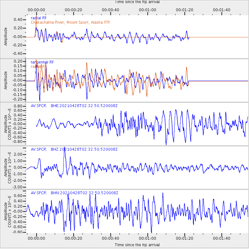
SPCR Ckakachatna River, Mount Spurr, Alaska - Earthquake Result Viewer
*The percent match for this event was below the threshold and hence no stack was calculated.
| Earthquake location: |
Northeastern India |
| Earthquake latitude/longitude: |
26.8/92.4 |
| Earthquake time(UTC): |
2021/04/28 (118) 02:21:25 GMT |
| Earthquake Depth: |
29 km |
| Earthquake Magnitude: |
6.0 mww |
| Earthquake Catalog/Contributor: |
NEIC PDE/us |
|
| Network: |
AV Alaska Volcano Observatory |
| Station: |
SPCR Ckakachatna River, Mount Spurr, Alaska |
| Lat/Lon: |
61.20 N/152.21 W |
| Elevation: |
984 m |
|
| Distance: |
78.1 deg |
| Az: |
26.564 deg |
| Baz: |
304.359 deg |
| Ray Param: |
$rayparam |
*The percent match for this event was below the threshold and hence was not used in the summary stack. |
|
| Radial Match: |
79.07995 % |
| Radial Bump: |
400 |
| Transverse Match: |
77.23096 % |
| Transverse Bump: |
400 |
| SOD ConfigId: |
24334971 |
| Insert Time: |
2021-05-12 02:29:03.286 +0000 |
| GWidth: |
2.5 |
| Max Bumps: |
400 |
| Tol: |
0.001 |
|
Signal To Noise
| Channel | StoN | STA | LTA |
| AV:SPCR: :BHZ:20210428T02:32:50.520008Z | 6.646403 | 8.223944E-7 | 1.2373526E-7 |
| AV:SPCR: :BHN:20210428T02:32:50.520008Z | 1.1992598 | 1.395182E-7 | 1.1633693E-7 |
| AV:SPCR: :BHE:20210428T02:32:50.520008Z | 1.3758678 | 1.4597842E-7 | 1.0609915E-7 |
| Arrivals |
| Ps | |
| PpPs | |
| PsPs/PpSs | |


