You are here: Home > Network List > CI - Caltech Regional Seismic Network Stations List
> Station SWS Sam W. Stewart, Westmorland, CA, USA > Earthquake Result Viewer
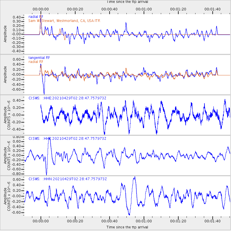
SWS Sam W. Stewart, Westmorland, CA, USA - Earthquake Result Viewer
*The percent match for this event was below the threshold and hence no stack was calculated.
| Earthquake location: |
Southern Argentina |
| Earthquake latitude/longitude: |
-37.3/-70.8 |
| Earthquake time(UTC): |
2021/04/29 (119) 02:17:16 GMT |
| Earthquake Depth: |
137 km |
| Earthquake Magnitude: |
5.7 Mww |
| Earthquake Catalog/Contributor: |
NEIC PDE/us |
|
| Network: |
CI Caltech Regional Seismic Network |
| Station: |
SWS Sam W. Stewart, Westmorland, CA, USA |
| Lat/Lon: |
32.94 N/115.80 W |
| Elevation: |
140 m |
|
| Distance: |
81.5 deg |
| Az: |
323.04 deg |
| Baz: |
145.221 deg |
| Ray Param: |
$rayparam |
*The percent match for this event was below the threshold and hence was not used in the summary stack. |
|
| Radial Match: |
49.673756 % |
| Radial Bump: |
400 |
| Transverse Match: |
82.713196 % |
| Transverse Bump: |
400 |
| SOD ConfigId: |
24334971 |
| Insert Time: |
2021-05-13 02:22:25.153 +0000 |
| GWidth: |
2.5 |
| Max Bumps: |
400 |
| Tol: |
0.001 |
|
Signal To Noise
| Channel | StoN | STA | LTA |
| CI:SWS: :HHZ:20210429T02:28:47.757973Z | 3.691531 | 3.748079E-7 | 1.0153183E-7 |
| CI:SWS: :HHN:20210429T02:28:47.757973Z | 1.2036877 | 1.9073669E-7 | 1.5846028E-7 |
| CI:SWS: :HHE:20210429T02:28:47.757973Z | 0.91059554 | 1.2445481E-7 | 1.3667409E-7 |
| Arrivals |
| Ps | |
| PpPs | |
| PsPs/PpSs | |


