You are here: Home > Network List > US - United States National Seismic Network Stations List
> Station HLID Hailey, Idaho, USA > Earthquake Result Viewer
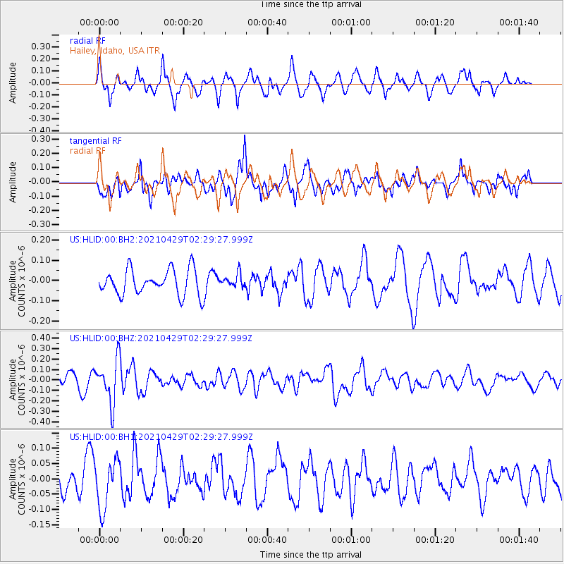
HLID Hailey, Idaho, USA - Earthquake Result Viewer
*The percent match for this event was below the threshold and hence no stack was calculated.
| Earthquake location: |
Southern Argentina |
| Earthquake latitude/longitude: |
-37.3/-70.8 |
| Earthquake time(UTC): |
2021/04/29 (119) 02:17:16 GMT |
| Earthquake Depth: |
137 km |
| Earthquake Magnitude: |
5.7 Mww |
| Earthquake Catalog/Contributor: |
NEIC PDE/us |
|
| Network: |
US United States National Seismic Network |
| Station: |
HLID Hailey, Idaho, USA |
| Lat/Lon: |
43.56 N/114.41 W |
| Elevation: |
1772 m |
|
| Distance: |
89.7 deg |
| Az: |
329.9 deg |
| Baz: |
146.607 deg |
| Ray Param: |
$rayparam |
*The percent match for this event was below the threshold and hence was not used in the summary stack. |
|
| Radial Match: |
54.807083 % |
| Radial Bump: |
400 |
| Transverse Match: |
59.04745 % |
| Transverse Bump: |
400 |
| SOD ConfigId: |
24334971 |
| Insert Time: |
2021-05-13 02:37:22.509 +0000 |
| GWidth: |
2.5 |
| Max Bumps: |
400 |
| Tol: |
0.001 |
|
Signal To Noise
| Channel | StoN | STA | LTA |
| US:HLID:00:BHZ:20210429T02:29:27.999Z | 4.361503 | 2.1493877E-7 | 4.9280896E-8 |
| US:HLID:00:BH1:20210429T02:29:27.999Z | 1.7138958 | 7.928694E-8 | 4.626124E-8 |
| US:HLID:00:BH2:20210429T02:29:27.999Z | 0.5447139 | 3.42832E-8 | 6.293799E-8 |
| Arrivals |
| Ps | |
| PpPs | |
| PsPs/PpSs | |


