You are here: Home > Network List > WY - Yellowstone Wyoming Seismic Network Stations List
> Station YHH Holmes Hill, YNP, WY, USA > Earthquake Result Viewer
YHH Holmes Hill, YNP, WY, USA - Earthquake Result Viewer
*The percent match for this event was below the threshold and hence no stack was calculated.
| Earthquake location: |
Southern Argentina |
| Earthquake latitude/longitude: |
-37.3/-70.8 |
| Earthquake time(UTC): |
2021/04/29 (119) 02:17:16 GMT |
| Earthquake Depth: |
137 km |
| Earthquake Magnitude: |
5.7 Mww |
| Earthquake Catalog/Contributor: |
NEIC PDE/us |
|
| Network: |
WY Yellowstone Wyoming Seismic Network |
| Station: |
YHH Holmes Hill, YNP, WY, USA |
| Lat/Lon: |
44.79 N/110.85 W |
| Elevation: |
2717 m |
|
| Distance: |
89.3 deg |
| Az: |
332.723 deg |
| Baz: |
149.106 deg |
| Ray Param: |
$rayparam |
*The percent match for this event was below the threshold and hence was not used in the summary stack. |
|
| Radial Match: |
48.712227 % |
| Radial Bump: |
400 |
| Transverse Match: |
54.371964 % |
| Transverse Bump: |
400 |
| SOD ConfigId: |
24334971 |
| Insert Time: |
2021-05-13 02:40:06.485 +0000 |
| GWidth: |
2.5 |
| Max Bumps: |
400 |
| Tol: |
0.001 |
|
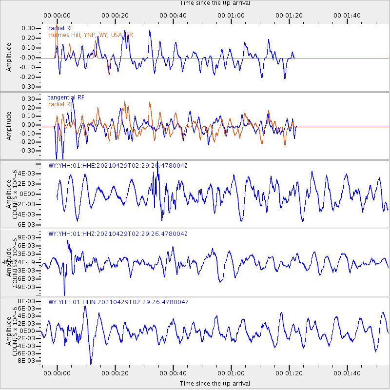
Signal To Noise
| Channel | StoN | STA | LTA |
| WY:YHH:01:HHZ:20210429T02:29:26.478004Z | 1.8634492 | 4.384618E-9 | 2.352958E-9 |
| WY:YHH:01:HHN:20210429T02:29:26.478004Z | 1.9058176 | 1.6099397E-9 | 8.4475016E-10 |
| WY:YHH:01:HHE:20210429T02:29:26.478004Z | 1.0243394 | 2.0553623E-9 | 2.0065245E-9 |
| Arrivals |
| Ps | |
| PpPs | |
| PsPs/PpSs | |


