You are here: Home > Network List > AZ - ANZA Regional Network Stations List
> Station SMER AZ.SMER > Earthquake Result Viewer
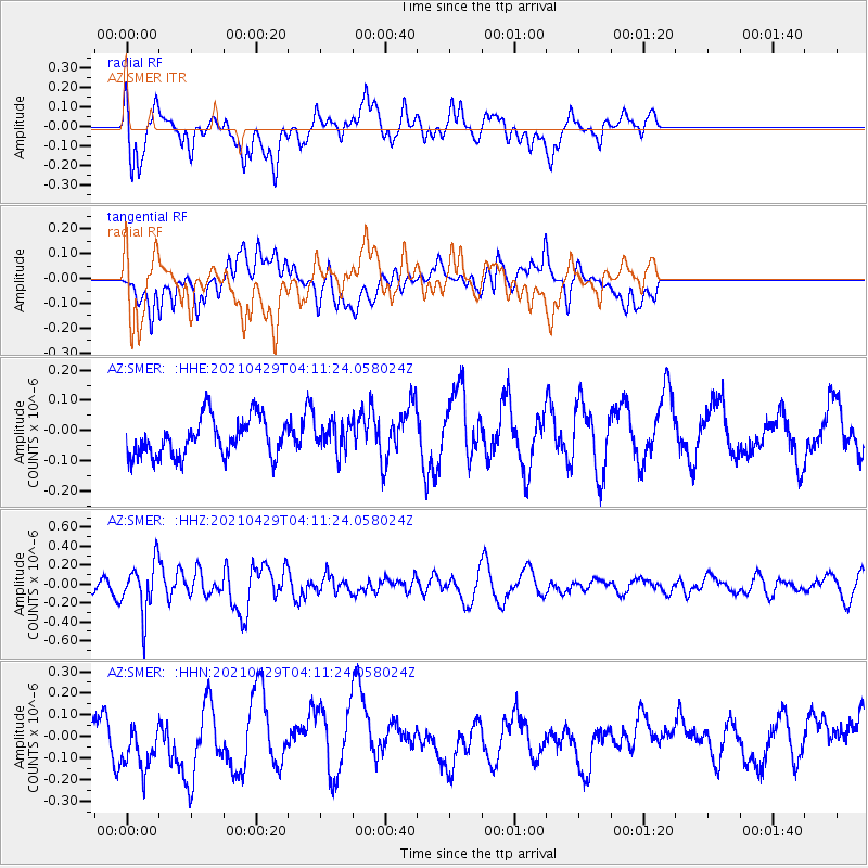
SMER AZ.SMER - Earthquake Result Viewer
*The percent match for this event was below the threshold and hence no stack was calculated.
| Earthquake location: |
Off E. Coast Of N. Island, N.Z. |
| Earthquake latitude/longitude: |
-37.6/179.4 |
| Earthquake time(UTC): |
2021/04/29 (119) 03:58:48 GMT |
| Earthquake Depth: |
23 km |
| Earthquake Magnitude: |
5.8 Mww |
| Earthquake Catalog/Contributor: |
NEIC PDE/us |
|
| Network: |
AZ ANZA Regional Network |
| Station: |
SMER AZ.SMER |
| Lat/Lon: |
33.46 N/117.17 W |
| Elevation: |
355 m |
|
| Distance: |
92.1 deg |
| Az: |
48.422 deg |
| Baz: |
225.294 deg |
| Ray Param: |
$rayparam |
*The percent match for this event was below the threshold and hence was not used in the summary stack. |
|
| Radial Match: |
44.03672 % |
| Radial Bump: |
400 |
| Transverse Match: |
31.651405 % |
| Transverse Bump: |
400 |
| SOD ConfigId: |
24334971 |
| Insert Time: |
2021-05-13 04:02:01.631 +0000 |
| GWidth: |
2.5 |
| Max Bumps: |
400 |
| Tol: |
0.001 |
|
Signal To Noise
| Channel | StoN | STA | LTA |
| AZ:SMER: :HHZ:20210429T04:11:24.058024Z | 2.9268343 | 2.698212E-7 | 9.218874E-8 |
| AZ:SMER: :HHN:20210429T04:11:24.058024Z | 1.1204642 | 1.239096E-7 | 1.10587735E-7 |
| AZ:SMER: :HHE:20210429T04:11:24.058024Z | 0.77927554 | 4.9171742E-8 | 6.30993E-8 |
| Arrivals |
| Ps | |
| PpPs | |
| PsPs/PpSs | |


