You are here: Home > Network List > IU - Global Seismograph Network (GSN - IRIS/USGS) Stations List
> Station CTAO Charters Towers, Australia > Earthquake Result Viewer
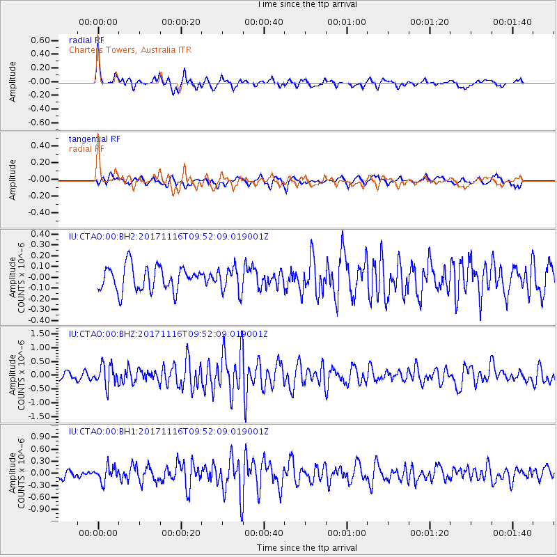
CTAO Charters Towers, Australia - Earthquake Result Viewer
*The percent match for this event was below the threshold and hence no stack was calculated.
| Earthquake location: |
Southeast Of Honshu, Japan |
| Earthquake latitude/longitude: |
32.2/140.5 |
| Earthquake time(UTC): |
2017/11/16 (320) 09:43:35 GMT |
| Earthquake Depth: |
71 km |
| Earthquake Magnitude: |
5.8 Mww |
| Earthquake Catalog/Contributor: |
NEIC PDE/us |
|
| Network: |
IU Global Seismograph Network (GSN - IRIS/USGS) |
| Station: |
CTAO Charters Towers, Australia |
| Lat/Lon: |
20.09 S/146.25 E |
| Elevation: |
357 m |
|
| Distance: |
52.3 deg |
| Az: |
173.212 deg |
| Baz: |
353.879 deg |
| Ray Param: |
$rayparam |
*The percent match for this event was below the threshold and hence was not used in the summary stack. |
|
| Radial Match: |
78.06745 % |
| Radial Bump: |
370 |
| Transverse Match: |
61.129627 % |
| Transverse Bump: |
400 |
| SOD ConfigId: |
2429771 |
| Insert Time: |
2017-11-30 09:45:40.623 +0000 |
| GWidth: |
2.5 |
| Max Bumps: |
400 |
| Tol: |
0.001 |
|
Signal To Noise
| Channel | StoN | STA | LTA |
| IU:CTAO:00:BHZ:20171116T09:52:09.019001Z | 2.7477727 | 3.866867E-7 | 1.4072732E-7 |
| IU:CTAO:00:BH1:20171116T09:52:09.019001Z | 2.0177588 | 1.902178E-7 | 9.4271826E-8 |
| IU:CTAO:00:BH2:20171116T09:52:09.019001Z | 1.0617212 | 1.1929595E-7 | 1.123609E-7 |
| Arrivals |
| Ps | |
| PpPs | |
| PsPs/PpSs | |


