You are here: Home > Network List > US - United States National Seismic Network Stations List
> Station AMTX Amarillo, Texas, USA > Earthquake Result Viewer
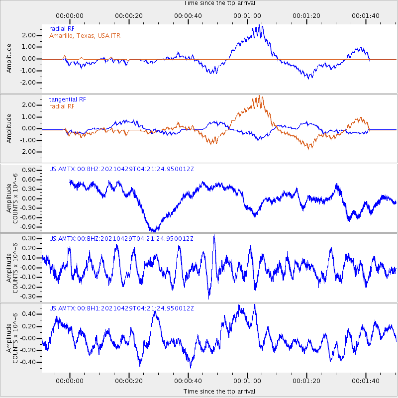
AMTX Amarillo, Texas, USA - Earthquake Result Viewer
*The percent match for this event was below the threshold and hence no stack was calculated.
| Earthquake location: |
Mariana Islands |
| Earthquake latitude/longitude: |
18.4/145.6 |
| Earthquake time(UTC): |
2021/04/29 (119) 04:08:44 GMT |
| Earthquake Depth: |
179 km |
| Earthquake Magnitude: |
5.5 mww |
| Earthquake Catalog/Contributor: |
NEIC PDE/us |
|
| Network: |
US United States National Seismic Network |
| Station: |
AMTX Amarillo, Texas, USA |
| Lat/Lon: |
34.53 N/101.41 W |
| Elevation: |
1010 m |
|
| Distance: |
97.4 deg |
| Az: |
50.028 deg |
| Baz: |
298.199 deg |
| Ray Param: |
$rayparam |
*The percent match for this event was below the threshold and hence was not used in the summary stack. |
|
| Radial Match: |
46.329716 % |
| Radial Bump: |
400 |
| Transverse Match: |
54.27459 % |
| Transverse Bump: |
400 |
| SOD ConfigId: |
24334971 |
| Insert Time: |
2021-05-13 04:23:34.938 +0000 |
| GWidth: |
2.5 |
| Max Bumps: |
400 |
| Tol: |
0.001 |
|
Signal To Noise
| Channel | StoN | STA | LTA |
| US:AMTX:00:BHZ:20210429T04:21:24.950012Z | 1.1547749 | 1.061199E-7 | 9.189661E-8 |
| US:AMTX:00:BH1:20210429T04:21:24.950012Z | 1.3171073 | 1.6861354E-7 | 1.2801807E-7 |
| US:AMTX:00:BH2:20210429T04:21:24.950012Z | 2.3976963 | 7.4158805E-7 | 3.0929192E-7 |
| Arrivals |
| Ps | |
| PpPs | |
| PsPs/PpSs | |


