You are here: Home > Network List > UW - Pacific Northwest Regional Seismic Network Stations List
> Station IRON Crane, OR, USA > Earthquake Result Viewer
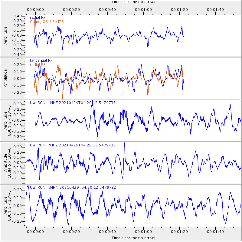
IRON Crane, OR, USA - Earthquake Result Viewer
*The percent match for this event was below the threshold and hence no stack was calculated.
| Earthquake location: |
Mariana Islands |
| Earthquake latitude/longitude: |
18.4/145.6 |
| Earthquake time(UTC): |
2021/04/29 (119) 04:08:44 GMT |
| Earthquake Depth: |
179 km |
| Earthquake Magnitude: |
5.5 mww |
| Earthquake Catalog/Contributor: |
NEIC PDE/us |
|
| Network: |
UW Pacific Northwest Regional Seismic Network |
| Station: |
IRON Crane, OR, USA |
| Lat/Lon: |
43.36 N/118.47 W |
| Elevation: |
1226 m |
|
| Distance: |
81.8 deg |
| Az: |
47.139 deg |
| Baz: |
287.415 deg |
| Ray Param: |
$rayparam |
*The percent match for this event was below the threshold and hence was not used in the summary stack. |
|
| Radial Match: |
59.57356 % |
| Radial Bump: |
400 |
| Transverse Match: |
67.01657 % |
| Transverse Bump: |
400 |
| SOD ConfigId: |
24334971 |
| Insert Time: |
2021-05-13 04:24:32.051 +0000 |
| GWidth: |
2.5 |
| Max Bumps: |
400 |
| Tol: |
0.001 |
|
Signal To Noise
| Channel | StoN | STA | LTA |
| UW:IRON: :HHZ:20210429T04:20:12.547973Z | 1.8596485 | 1.3107243E-7 | 7.0482365E-8 |
| UW:IRON: :HHN:20210429T04:20:12.547973Z | 1.0045748 | 1.0666169E-7 | 1.0617595E-7 |
| UW:IRON: :HHE:20210429T04:20:12.547973Z | 3.396877 | 1.8488292E-7 | 5.442732E-8 |
| Arrivals |
| Ps | |
| PpPs | |
| PsPs/PpSs | |


