You are here: Home > Network List > PF - Volcanologic Network of Piton de Fournaise-OVPF Stations List
> Station HIM cratere Himiltrude > Earthquake Result Viewer
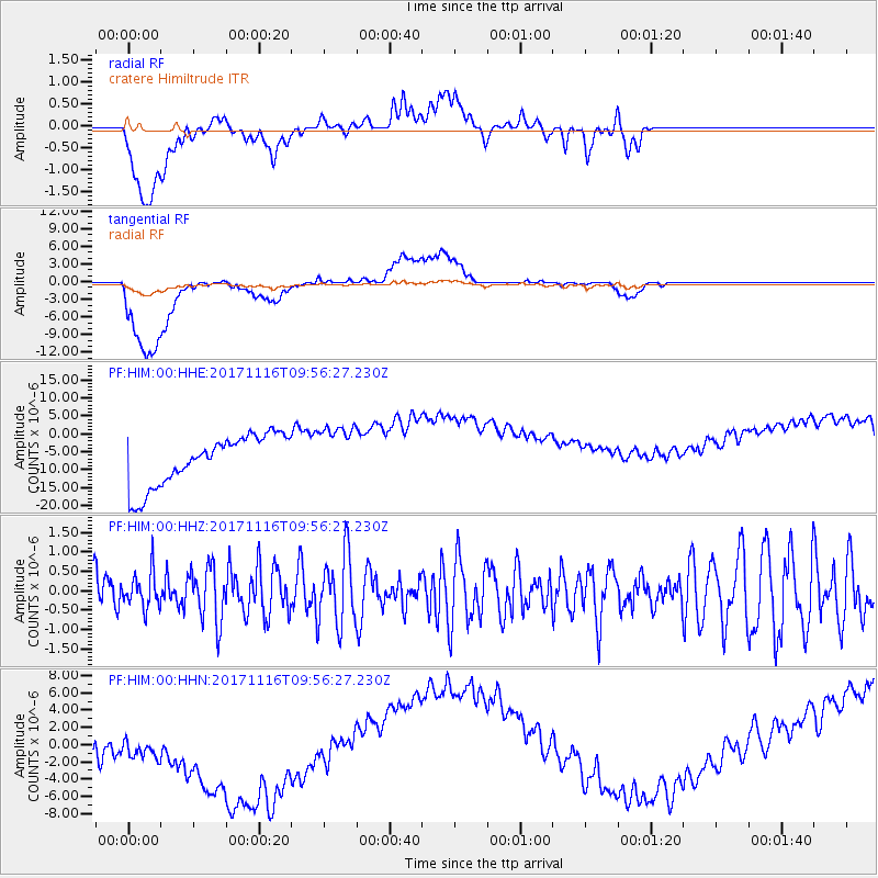
HIM cratere Himiltrude - Earthquake Result Viewer
*The percent match for this event was below the threshold and hence no stack was calculated.
| Earthquake location: |
Southeast Of Honshu, Japan |
| Earthquake latitude/longitude: |
32.2/140.5 |
| Earthquake time(UTC): |
2017/11/16 (320) 09:43:35 GMT |
| Earthquake Depth: |
71 km |
| Earthquake Magnitude: |
5.8 Mww |
| Earthquake Catalog/Contributor: |
NEIC PDE/us |
|
| Network: |
PF Volcanologic Network of Piton de Fournaise-OVPF |
| Station: |
HIM cratere Himiltrude |
| Lat/Lon: |
21.21 S/55.72 E |
| Elevation: |
1958 m |
|
| Distance: |
96.9 deg |
| Az: |
249.383 deg |
| Baz: |
58.272 deg |
| Ray Param: |
$rayparam |
*The percent match for this event was below the threshold and hence was not used in the summary stack. |
|
| Radial Match: |
35.73714 % |
| Radial Bump: |
400 |
| Transverse Match: |
30.930742 % |
| Transverse Bump: |
400 |
| SOD ConfigId: |
2429771 |
| Insert Time: |
2017-11-30 09:47:08.563 +0000 |
| GWidth: |
2.5 |
| Max Bumps: |
400 |
| Tol: |
0.001 |
|
Signal To Noise
| Channel | StoN | STA | LTA |
| PF:HIM:00:HHZ:20171116T09:56:27.230Z | 0.7109009 | 4.6149106E-7 | 6.4916367E-7 |
| PF:HIM:00:HHN:20171116T09:56:27.230Z | 1.0819165 | 8.325903E-6 | 7.695515E-6 |
| PF:HIM:00:HHE:20171116T09:56:27.230Z | 1.1350067 | 8.021101E-6 | 7.067008E-6 |
| Arrivals |
| Ps | |
| PpPs | |
| PsPs/PpSs | |


