You are here: Home > Network List > AV - Alaska Volcano Observatory Stations List
> Station MAPS Pakushin Southeast, Makushin Volcano, Alaska > Earthquake Result Viewer
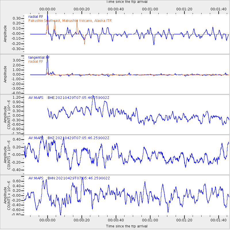
MAPS Pakushin Southeast, Makushin Volcano, Alaska - Earthquake Result Viewer
*The percent match for this event was below the threshold and hence no stack was calculated.
| Earthquake location: |
Kermadec Islands Region |
| Earthquake latitude/longitude: |
-29.1/-177.0 |
| Earthquake time(UTC): |
2021/04/29 (119) 06:53:52 GMT |
| Earthquake Depth: |
10 km |
| Earthquake Magnitude: |
5.5 mb |
| Earthquake Catalog/Contributor: |
NEIC PDE/us |
|
| Network: |
AV Alaska Volcano Observatory |
| Station: |
MAPS Pakushin Southeast, Makushin Volcano, Alaska |
| Lat/Lon: |
53.81 N/166.94 W |
| Elevation: |
333 m |
|
| Distance: |
83.0 deg |
| Az: |
5.986 deg |
| Baz: |
188.855 deg |
| Ray Param: |
$rayparam |
*The percent match for this event was below the threshold and hence was not used in the summary stack. |
|
| Radial Match: |
43.954327 % |
| Radial Bump: |
400 |
| Transverse Match: |
90.65094 % |
| Transverse Bump: |
188 |
| SOD ConfigId: |
24334971 |
| Insert Time: |
2021-05-13 07:22:47.199 +0000 |
| GWidth: |
2.5 |
| Max Bumps: |
400 |
| Tol: |
0.001 |
|
Signal To Noise
| Channel | StoN | STA | LTA |
| AV:MAPS: :BHZ:20210429T07:05:46.259002Z | 1.921177 | 3.3878962E-7 | 1.7634481E-7 |
| AV:MAPS: :BHN:20210429T07:05:46.259002Z | 1.4475585 | 3.4963023E-7 | 2.4153098E-7 |
| AV:MAPS: :BHE:20210429T07:05:46.259002Z | 1.9253427 | 4.2996652E-7 | 2.2331947E-7 |
| Arrivals |
| Ps | |
| PpPs | |
| PsPs/PpSs | |


