You are here: Home > Network List > TA - USArray Transportable Network (new EarthScope stations) Stations List
> Station TOLK Toolik Lake Research Station, AK, USA > Earthquake Result Viewer
TOLK Toolik Lake Research Station, AK, USA - Earthquake Result Viewer
*The percent match for this event was below the threshold and hence no stack was calculated.
| Earthquake location: |
Southeast Of Honshu, Japan |
| Earthquake latitude/longitude: |
32.2/140.5 |
| Earthquake time(UTC): |
2017/11/16 (320) 09:43:35 GMT |
| Earthquake Depth: |
71 km |
| Earthquake Magnitude: |
5.8 Mww |
| Earthquake Catalog/Contributor: |
NEIC PDE/us |
|
| Network: |
TA USArray Transportable Network (new EarthScope stations) |
| Station: |
TOLK Toolik Lake Research Station, AK, USA |
| Lat/Lon: |
68.64 N/149.57 W |
| Elevation: |
760 m |
|
| Distance: |
53.1 deg |
| Az: |
25.469 deg |
| Baz: |
264.462 deg |
| Ray Param: |
$rayparam |
*The percent match for this event was below the threshold and hence was not used in the summary stack. |
|
| Radial Match: |
73.94992 % |
| Radial Bump: |
400 |
| Transverse Match: |
48.087543 % |
| Transverse Bump: |
400 |
| SOD ConfigId: |
2429771 |
| Insert Time: |
2017-11-30 09:47:20.559 +0000 |
| GWidth: |
2.5 |
| Max Bumps: |
400 |
| Tol: |
0.001 |
|
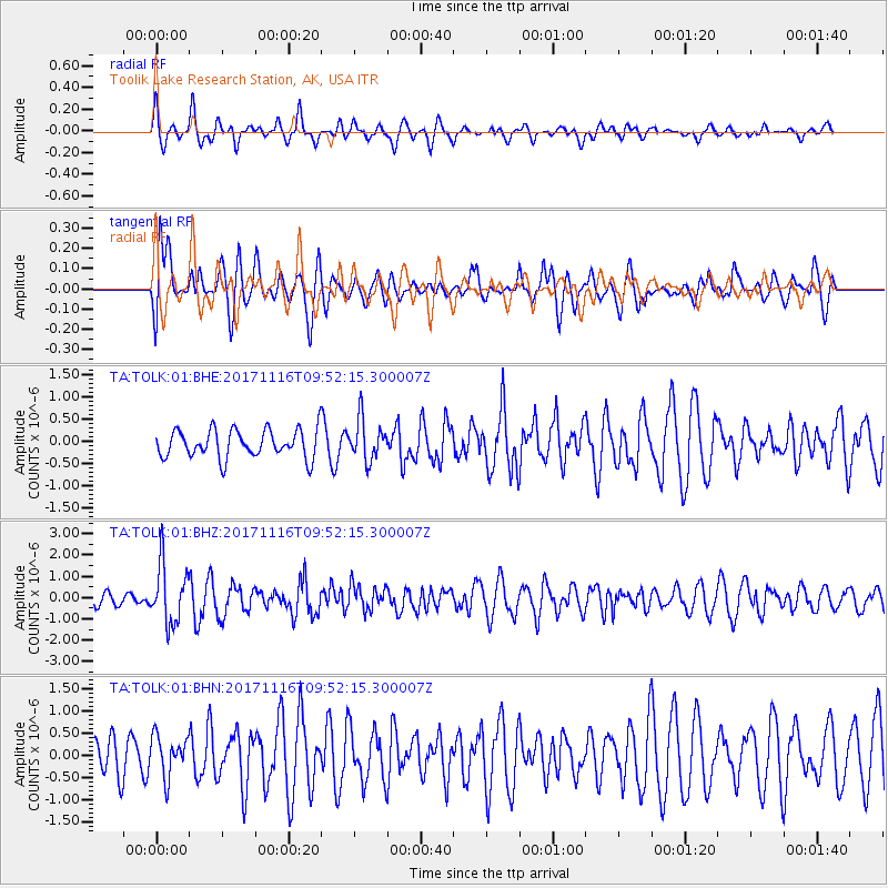
Signal To Noise
| Channel | StoN | STA | LTA |
| TA:TOLK:01:BHZ:20171116T09:52:15.300007Z | 4.491207 | 1.3831385E-6 | 3.0796588E-7 |
| TA:TOLK:01:BHN:20171116T09:52:15.300007Z | 1.2138487 | 4.521063E-7 | 3.724569E-7 |
| TA:TOLK:01:BHE:20171116T09:52:15.300007Z | 1.4455622 | 4.5583243E-7 | 3.1533227E-7 |
| Arrivals |
| Ps | |
| PpPs | |
| PsPs/PpSs | |


