You are here: Home > Network List > TA - USArray Transportable Network (new EarthScope stations) Stations List
> Station TUL3 Leonard, OK, USA > Earthquake Result Viewer
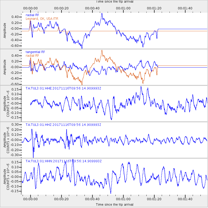
TUL3 Leonard, OK, USA - Earthquake Result Viewer
*The percent match for this event was below the threshold and hence no stack was calculated.
| Earthquake location: |
Southeast Of Honshu, Japan |
| Earthquake latitude/longitude: |
32.2/140.5 |
| Earthquake time(UTC): |
2017/11/16 (320) 09:43:35 GMT |
| Earthquake Depth: |
71 km |
| Earthquake Magnitude: |
5.8 Mww |
| Earthquake Catalog/Contributor: |
NEIC PDE/us |
|
| Network: |
TA USArray Transportable Network (new EarthScope stations) |
| Station: |
TUL3 Leonard, OK, USA |
| Lat/Lon: |
35.91 N/95.79 W |
| Elevation: |
265 m |
|
| Distance: |
94.1 deg |
| Az: |
42.644 deg |
| Baz: |
314.961 deg |
| Ray Param: |
$rayparam |
*The percent match for this event was below the threshold and hence was not used in the summary stack. |
|
| Radial Match: |
62.228516 % |
| Radial Bump: |
400 |
| Transverse Match: |
51.48945 % |
| Transverse Bump: |
400 |
| SOD ConfigId: |
2429771 |
| Insert Time: |
2017-11-30 09:47:20.804 +0000 |
| GWidth: |
2.5 |
| Max Bumps: |
400 |
| Tol: |
0.001 |
|
Signal To Noise
| Channel | StoN | STA | LTA |
| TA:TUL3:01:HHZ:20171116T09:56:14.909993Z | 3.8896267 | 1.2345681E-7 | 3.1740015E-8 |
| TA:TUL3:01:HHN:20171116T09:56:14.909993Z | 1.8763585 | 6.3083085E-8 | 3.3619955E-8 |
| TA:TUL3:01:HHE:20171116T09:56:14.909993Z | 1.2504328 | 4.092485E-8 | 3.2728547E-8 |
| Arrivals |
| Ps | |
| PpPs | |
| PsPs/PpSs | |


