You are here: Home > Network List > US - United States National Seismic Network Stations List
> Station HAWA Hanford, Washington, USA > Earthquake Result Viewer
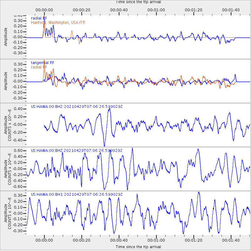
HAWA Hanford, Washington, USA - Earthquake Result Viewer
*The percent match for this event was below the threshold and hence no stack was calculated.
| Earthquake location: |
Kermadec Islands Region |
| Earthquake latitude/longitude: |
-29.1/-177.0 |
| Earthquake time(UTC): |
2021/04/29 (119) 06:53:52 GMT |
| Earthquake Depth: |
10 km |
| Earthquake Magnitude: |
5.5 mb |
| Earthquake Catalog/Contributor: |
NEIC PDE/us |
|
| Network: |
US United States National Seismic Network |
| Station: |
HAWA Hanford, Washington, USA |
| Lat/Lon: |
46.39 N/119.53 W |
| Elevation: |
364 m |
|
| Distance: |
91.3 deg |
| Az: |
35.707 deg |
| Baz: |
227.574 deg |
| Ray Param: |
$rayparam |
*The percent match for this event was below the threshold and hence was not used in the summary stack. |
|
| Radial Match: |
65.274475 % |
| Radial Bump: |
400 |
| Transverse Match: |
44.49416 % |
| Transverse Bump: |
400 |
| SOD ConfigId: |
24334971 |
| Insert Time: |
2021-05-13 07:32:16.799 +0000 |
| GWidth: |
2.5 |
| Max Bumps: |
400 |
| Tol: |
0.001 |
|
Signal To Noise
| Channel | StoN | STA | LTA |
| US:HAWA:00:BHZ:20210429T07:06:26.599029Z | 0.688945 | 1.514164E-7 | 2.197801E-7 |
| US:HAWA:00:BH1:20210429T07:06:26.599029Z | 0.8753069 | 1.0918023E-7 | 1.2473365E-7 |
| US:HAWA:00:BH2:20210429T07:06:26.599029Z | 2.6114018 | 2.987096E-7 | 1.1438669E-7 |
| Arrivals |
| Ps | |
| PpPs | |
| PsPs/PpSs | |


