You are here: Home > Network List > UW - Pacific Northwest Regional Seismic Network Stations List
> Station IRON Crane, OR, USA > Earthquake Result Viewer
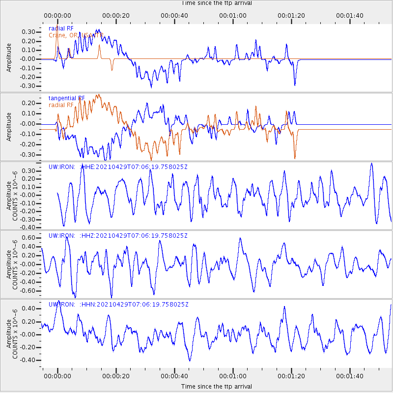
IRON Crane, OR, USA - Earthquake Result Viewer
*The percent match for this event was below the threshold and hence no stack was calculated.
| Earthquake location: |
Kermadec Islands Region |
| Earthquake latitude/longitude: |
-29.1/-177.0 |
| Earthquake time(UTC): |
2021/04/29 (119) 06:53:52 GMT |
| Earthquake Depth: |
10 km |
| Earthquake Magnitude: |
5.5 mb |
| Earthquake Catalog/Contributor: |
NEIC PDE/us |
|
| Network: |
UW Pacific Northwest Regional Seismic Network |
| Station: |
IRON Crane, OR, USA |
| Lat/Lon: |
43.36 N/118.47 W |
| Elevation: |
1226 m |
|
| Distance: |
89.8 deg |
| Az: |
38.464 deg |
| Baz: |
228.291 deg |
| Ray Param: |
$rayparam |
*The percent match for this event was below the threshold and hence was not used in the summary stack. |
|
| Radial Match: |
43.263096 % |
| Radial Bump: |
400 |
| Transverse Match: |
44.20819 % |
| Transverse Bump: |
400 |
| SOD ConfigId: |
24334971 |
| Insert Time: |
2021-05-13 07:32:53.885 +0000 |
| GWidth: |
2.5 |
| Max Bumps: |
400 |
| Tol: |
0.001 |
|
Signal To Noise
| Channel | StoN | STA | LTA |
| UW:IRON: :HHZ:20210429T07:06:19.758025Z | 1.5982537 | 3.4737104E-7 | 2.1734411E-7 |
| UW:IRON: :HHN:20210429T07:06:19.758025Z | 1.3729101 | 4.9580757E-7 | 3.6113622E-7 |
| UW:IRON: :HHE:20210429T07:06:19.758025Z | 0.9038306 | 1.6026517E-7 | 1.7731772E-7 |
| Arrivals |
| Ps | |
| PpPs | |
| PsPs/PpSs | |


