You are here: Home > Network List > US - United States National Seismic Network Stations List
> Station ERPA Erie, Pennsylvania, USA > Earthquake Result Viewer
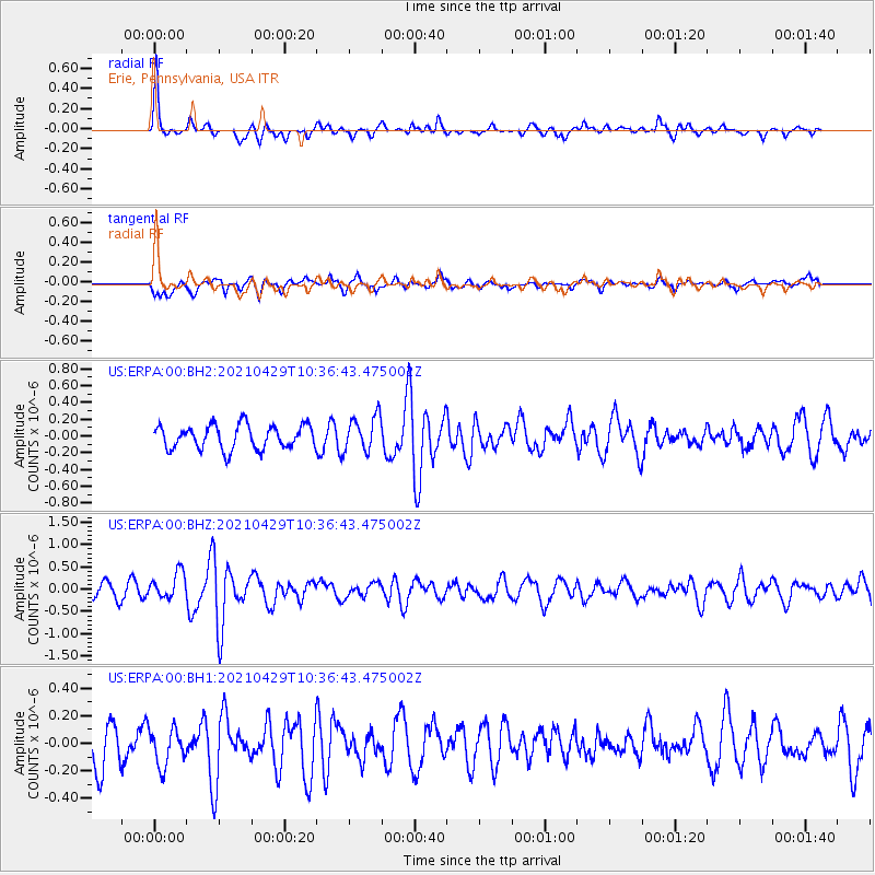
ERPA Erie, Pennsylvania, USA - Earthquake Result Viewer
*The percent match for this event was below the threshold and hence no stack was calculated.
| Earthquake location: |
Off Coast Of Oregon |
| Earthquake latitude/longitude: |
43.8/-128.1 |
| Earthquake time(UTC): |
2021/04/29 (119) 10:30:23 GMT |
| Earthquake Depth: |
10 km |
| Earthquake Magnitude: |
5.5 Mww |
| Earthquake Catalog/Contributor: |
NEIC PDE/us |
|
| Network: |
US United States National Seismic Network |
| Station: |
ERPA Erie, Pennsylvania, USA |
| Lat/Lon: |
42.12 N/79.99 W |
| Elevation: |
306 m |
|
| Distance: |
34.9 deg |
| Az: |
75.75 deg |
| Baz: |
289.49 deg |
| Ray Param: |
$rayparam |
*The percent match for this event was below the threshold and hence was not used in the summary stack. |
|
| Radial Match: |
73.47471 % |
| Radial Bump: |
333 |
| Transverse Match: |
64.547485 % |
| Transverse Bump: |
394 |
| SOD ConfigId: |
24334971 |
| Insert Time: |
2021-05-13 10:42:39.377 +0000 |
| GWidth: |
2.5 |
| Max Bumps: |
400 |
| Tol: |
0.001 |
|
Signal To Noise
| Channel | StoN | STA | LTA |
| US:ERPA:00:BHZ:20210429T10:36:43.475002Z | 1.5167422 | 2.9622848E-7 | 1.9530576E-7 |
| US:ERPA:00:BH1:20210429T10:36:43.475002Z | 0.81106323 | 1.384036E-7 | 1.7064465E-7 |
| US:ERPA:00:BH2:20210429T10:36:43.475002Z | 1.4896747 | 2.1021988E-7 | 1.4111798E-7 |
| Arrivals |
| Ps | |
| PpPs | |
| PsPs/PpSs | |


