You are here: Home > Network List > US - United States National Seismic Network Stations List
> Station DUG Dugway, Tooele County, Utah, USA > Earthquake Result Viewer
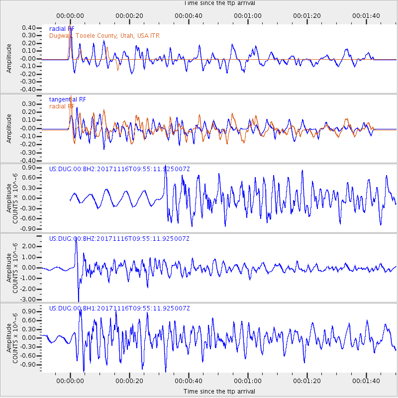
DUG Dugway, Tooele County, Utah, USA - Earthquake Result Viewer
*The percent match for this event was below the threshold and hence no stack was calculated.
| Earthquake location: |
Southeast Of Honshu, Japan |
| Earthquake latitude/longitude: |
32.2/140.5 |
| Earthquake time(UTC): |
2017/11/16 (320) 09:43:35 GMT |
| Earthquake Depth: |
71 km |
| Earthquake Magnitude: |
5.8 Mww |
| Earthquake Catalog/Contributor: |
NEIC PDE/us |
|
| Network: |
US United States National Seismic Network |
| Station: |
DUG Dugway, Tooele County, Utah, USA |
| Lat/Lon: |
40.19 N/112.81 W |
| Elevation: |
1477 m |
|
| Distance: |
81.1 deg |
| Az: |
47.976 deg |
| Baz: |
304.681 deg |
| Ray Param: |
$rayparam |
*The percent match for this event was below the threshold and hence was not used in the summary stack. |
|
| Radial Match: |
75.38295 % |
| Radial Bump: |
400 |
| Transverse Match: |
77.36582 % |
| Transverse Bump: |
400 |
| SOD ConfigId: |
2429771 |
| Insert Time: |
2017-11-30 09:48:37.621 +0000 |
| GWidth: |
2.5 |
| Max Bumps: |
400 |
| Tol: |
0.001 |
|
Signal To Noise
| Channel | StoN | STA | LTA |
| US:DUG:00:BHZ:20171116T09:55:11.925007Z | 7.2592826 | 1.2410345E-6 | 1.7095829E-7 |
| US:DUG:00:BH1:20171116T09:55:11.925007Z | 4.500755 | 4.952912E-7 | 1.1004625E-7 |
| US:DUG:00:BH2:20171116T09:55:11.925007Z | 2.852115 | 4.2186042E-7 | 1.4791144E-7 |
| Arrivals |
| Ps | |
| PpPs | |
| PsPs/PpSs | |


