You are here: Home > Network List > US - United States National Seismic Network Stations List
> Station EGMT Eagleton, Montana, USA > Earthquake Result Viewer
EGMT Eagleton, Montana, USA - Earthquake Result Viewer
*The percent match for this event was below the threshold and hence no stack was calculated.
| Earthquake location: |
Southeast Of Honshu, Japan |
| Earthquake latitude/longitude: |
32.2/140.5 |
| Earthquake time(UTC): |
2017/11/16 (320) 09:43:35 GMT |
| Earthquake Depth: |
71 km |
| Earthquake Magnitude: |
5.8 Mww |
| Earthquake Catalog/Contributor: |
NEIC PDE/us |
|
| Network: |
US United States National Seismic Network |
| Station: |
EGMT Eagleton, Montana, USA |
| Lat/Lon: |
48.02 N/109.75 W |
| Elevation: |
1055 m |
|
| Distance: |
78.4 deg |
| Az: |
40.18 deg |
| Baz: |
305.418 deg |
| Ray Param: |
$rayparam |
*The percent match for this event was below the threshold and hence was not used in the summary stack. |
|
| Radial Match: |
57.474472 % |
| Radial Bump: |
400 |
| Transverse Match: |
60.578823 % |
| Transverse Bump: |
400 |
| SOD ConfigId: |
2429771 |
| Insert Time: |
2017-11-30 09:48:42.806 +0000 |
| GWidth: |
2.5 |
| Max Bumps: |
400 |
| Tol: |
0.001 |
|
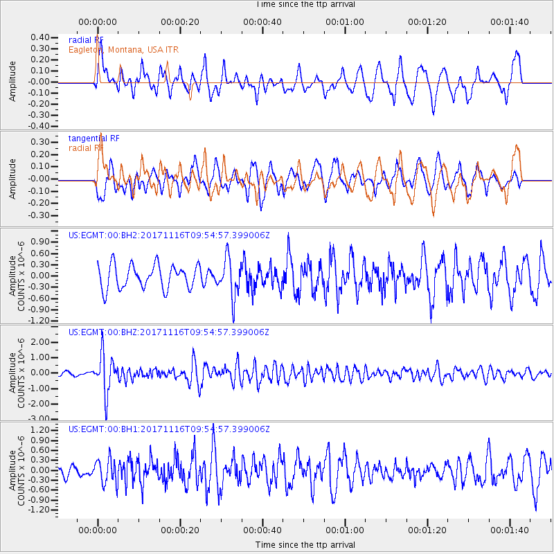
Signal To Noise
| Channel | StoN | STA | LTA |
| US:EGMT:00:BHZ:20171116T09:54:57.399006Z | 13.723568 | 1.2718533E-6 | 9.267657E-8 |
| US:EGMT:00:BH1:20171116T09:54:57.399006Z | 1.103277 | 3.8463938E-7 | 3.4863356E-7 |
| US:EGMT:00:BH2:20171116T09:54:57.399006Z | 1.6459194 | 5.183E-7 | 3.149E-7 |
| Arrivals |
| Ps | |
| PpPs | |
| PsPs/PpSs | |


