You are here: Home > Network List > US - United States National Seismic Network Stations List
> Station WMOK Wichita Mountains, Oklahoma, USA > Earthquake Result Viewer
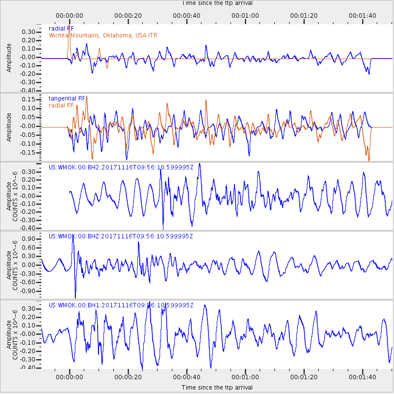
WMOK Wichita Mountains, Oklahoma, USA - Earthquake Result Viewer
*The percent match for this event was below the threshold and hence no stack was calculated.
| Earthquake location: |
Southeast Of Honshu, Japan |
| Earthquake latitude/longitude: |
32.2/140.5 |
| Earthquake time(UTC): |
2017/11/16 (320) 09:43:35 GMT |
| Earthquake Depth: |
71 km |
| Earthquake Magnitude: |
5.8 Mww |
| Earthquake Catalog/Contributor: |
NEIC PDE/us |
|
| Network: |
US United States National Seismic Network |
| Station: |
WMOK Wichita Mountains, Oklahoma, USA |
| Lat/Lon: |
34.74 N/98.78 W |
| Elevation: |
486 m |
|
| Distance: |
93.2 deg |
| Az: |
45.189 deg |
| Baz: |
313.077 deg |
| Ray Param: |
$rayparam |
*The percent match for this event was below the threshold and hence was not used in the summary stack. |
|
| Radial Match: |
35.043644 % |
| Radial Bump: |
351 |
| Transverse Match: |
41.566345 % |
| Transverse Bump: |
400 |
| SOD ConfigId: |
2429771 |
| Insert Time: |
2017-11-30 09:49:18.180 +0000 |
| GWidth: |
2.5 |
| Max Bumps: |
400 |
| Tol: |
0.001 |
|
Signal To Noise
| Channel | StoN | STA | LTA |
| US:WMOK:00:BHZ:20171116T09:56:10.599995Z | 2.7943323 | 4.498562E-7 | 1.609888E-7 |
| US:WMOK:00:BH1:20171116T09:56:10.599995Z | 1.321412 | 1.6243025E-7 | 1.2292175E-7 |
| US:WMOK:00:BH2:20171116T09:56:10.599995Z | 1.3940195 | 1.6147753E-7 | 1.15835924E-7 |
| Arrivals |
| Ps | |
| PpPs | |
| PsPs/PpSs | |


