You are here: Home > Network List > AZ - ANZA Regional Network Stations List
> Station BZN AZ.BZN > Earthquake Result Viewer
BZN AZ.BZN - Earthquake Result Viewer

| Earthquake location: |
Near East Coast Of Honshu, Japan |
| Earthquake latitude/longitude: |
38.1/141.8 |
| Earthquake time(UTC): |
2021/05/01 (121) 01:27:30 GMT |
| Earthquake Depth: |
56 km |
| Earthquake Magnitude: |
6.6 Mi |
| Earthquake Catalog/Contributor: |
NEIC PDE/at |
|
| Network: |
AZ ANZA Regional Network |
| Station: |
BZN AZ.BZN |
| Lat/Lon: |
33.49 N/116.67 W |
| Elevation: |
1301 m |
|
| Distance: |
78.1 deg |
| Az: |
56.791 deg |
| Baz: |
307.824 deg |
| Ray Param: |
0.049750574 |
| Estimated Moho Depth: |
31.25 km |
| Estimated Crust Vp/Vs: |
1.73 |
| Assumed Crust Vp: |
6.264 km/s |
| Estimated Crust Vs: |
3.631 km/s |
| Estimated Crust Poisson's Ratio: |
0.25 |
|
| Radial Match: |
91.70123 % |
| Radial Bump: |
374 |
| Transverse Match: |
78.44101 % |
| Transverse Bump: |
400 |
| SOD ConfigId: |
24334971 |
| Insert Time: |
2021-05-15 01:36:28.447 +0000 |
| GWidth: |
2.5 |
| Max Bumps: |
400 |
| Tol: |
0.001 |
|
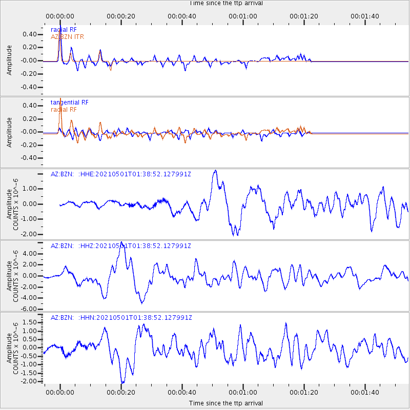
Signal To Noise
| Channel | StoN | STA | LTA |
| AZ:BZN: :HHZ:20210501T01:38:52.127991Z | 7.233682 | 8.9621057E-7 | 1.238941E-7 |
| AZ:BZN: :HHN:20210501T01:38:52.127991Z | 1.078072 | 2.737483E-7 | 2.5392396E-7 |
| AZ:BZN: :HHE:20210501T01:38:52.127991Z | 1.6538619 | 2.1531287E-7 | 1.3018794E-7 |
| Arrivals |
| Ps | 3.7 SECOND |
| PpPs | 13 SECOND |
| PsPs/PpSs | 17 SECOND |


