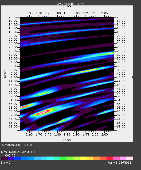
KENS XW.KENS - Earthquake Result Viewer
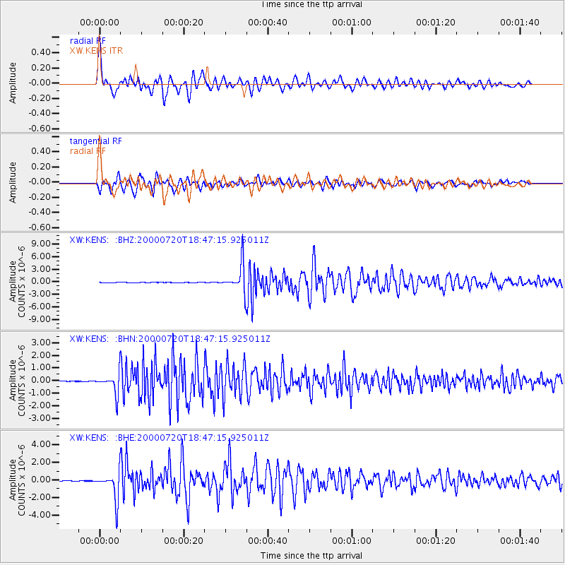
Earthquake location: Near East Coast Of Honshu, Japan
Earthquake latitude/longitude: 36.5/141.0
Earthquake time(UTC): 2000/07/20 (202) 18:39:18 GMT
Earthquake Depth: 47 km
Earthquake Magnitude: 6.1 MB, 5.4 MS, 6.1 ME, 6.0 MW
Earthquake Catalog/Contributor: WHDF/NEIC
Network: XW Tien Shan Continental Dynamics
Station: KENS XW.KENS
Lat/Lon: 42.32 N/79.24 E
Elevation: 2805 m
Distance: 47.1 deg
Az: 296.972 deg
Baz: 75.502 deg
Ray Param: 0.07006489
Estimated Moho Depth: 60.25 km
Estimated Crust Vp/Vs: 1.72
Assumed Crust Vp: 6.306 km/s
Estimated Crust Vs: 3.666 km/s
Estimated Crust Poisson's Ratio: 0.24
Radial Match: 88.792145 %
Radial Bump: 400
Transverse Match: 86.34119 %
Transverse Bump: 400
SOD ConfigId: 20082
Insert Time: 2010-02-26 15:32:59.405 +0000
GWidth: 2.5
Max Bumps: 400
Tol: 0.001

Signal To Noise

ChannelStoNSTALTA
XW:KENS: :BHN:20000720T18:47:15.925011Z39.304128.291779E-72.1096465E-8
XW:KENS: :BHE:20000720T18:47:15.925011Z55.6442681.6387113E-62.9449776E-8
XW:KENS: :BHZ:20000720T18:47:15.925011Z116.4202963.4866382E-62.9948716E-8
Arrivals
Ps7.3 SECOND
PpPs24 SECOND
PsPs/PpSs32 SECOND