You are here: Home > Network List > NE - New England Seismic Network Stations List
> Station EMMW Machias, ME, USA > Earthquake Result Viewer
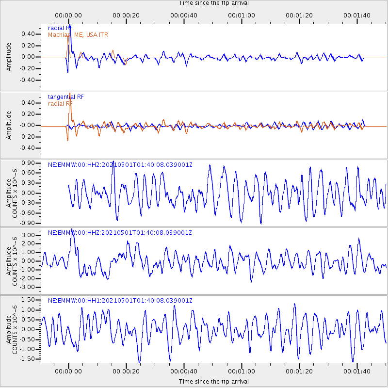
EMMW Machias, ME, USA - Earthquake Result Viewer
*The percent match for this event was below the threshold and hence no stack was calculated.
| Earthquake location: |
Near East Coast Of Honshu, Japan |
| Earthquake latitude/longitude: |
38.1/141.8 |
| Earthquake time(UTC): |
2021/05/01 (121) 01:27:30 GMT |
| Earthquake Depth: |
56 km |
| Earthquake Magnitude: |
6.6 Mi |
| Earthquake Catalog/Contributor: |
NEIC PDE/at |
|
| Network: |
NE New England Seismic Network |
| Station: |
EMMW Machias, ME, USA |
| Lat/Lon: |
44.71 N/67.46 W |
| Elevation: |
35 m |
|
| Distance: |
93.4 deg |
| Az: |
20.434 deg |
| Baz: |
337.277 deg |
| Ray Param: |
$rayparam |
*The percent match for this event was below the threshold and hence was not used in the summary stack. |
|
| Radial Match: |
77.00545 % |
| Radial Bump: |
400 |
| Transverse Match: |
54.41138 % |
| Transverse Bump: |
400 |
| SOD ConfigId: |
24334971 |
| Insert Time: |
2021-05-15 01:52:44.082 +0000 |
| GWidth: |
2.5 |
| Max Bumps: |
400 |
| Tol: |
0.001 |
|
Signal To Noise
| Channel | StoN | STA | LTA |
| NE:EMMW:00:HHZ:20210501T01:40:08.039001Z | 3.1091936 | 1.8852628E-6 | 6.063511E-7 |
| NE:EMMW:00:HH1:20210501T01:40:08.039001Z | 1.4987546 | 6.5582844E-7 | 4.3758226E-7 |
| NE:EMMW:00:HH2:20210501T01:40:08.039001Z | 1.1766951 | 3.7916078E-7 | 3.2222516E-7 |
| Arrivals |
| Ps | |
| PpPs | |
| PsPs/PpSs | |


