You are here: Home > Network List > UU - University of Utah Regional Network Stations List
> Station CCUT Cedar City, UT, USA > Earthquake Result Viewer
CCUT Cedar City, UT, USA - Earthquake Result Viewer
*The percent match for this event was below the threshold and hence no stack was calculated.
| Earthquake location: |
Solomon Islands |
| Earthquake latitude/longitude: |
-10.1/160.9 |
| Earthquake time(UTC): |
2017/11/16 (320) 14:50:04 GMT |
| Earthquake Depth: |
10 km |
| Earthquake Magnitude: |
5.6 mb |
| Earthquake Catalog/Contributor: |
NEIC PDE/us |
|
| Network: |
UU University of Utah Regional Network |
| Station: |
CCUT Cedar City, UT, USA |
| Lat/Lon: |
37.55 N/113.36 W |
| Elevation: |
2127 m |
|
| Distance: |
92.7 deg |
| Az: |
52.507 deg |
| Baz: |
259.446 deg |
| Ray Param: |
$rayparam |
*The percent match for this event was below the threshold and hence was not used in the summary stack. |
|
| Radial Match: |
55.85747 % |
| Radial Bump: |
400 |
| Transverse Match: |
48.063656 % |
| Transverse Bump: |
400 |
| SOD ConfigId: |
2429771 |
| Insert Time: |
2017-11-30 14:51:55.159 +0000 |
| GWidth: |
2.5 |
| Max Bumps: |
400 |
| Tol: |
0.001 |
|
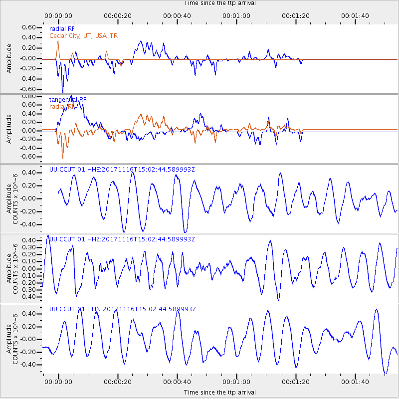
Signal To Noise
| Channel | StoN | STA | LTA |
| UU:CCUT:01:HHZ:20171116T15:02:44.589993Z | 1.310932 | 2.198025E-7 | 1.6766887E-7 |
| UU:CCUT:01:HHN:20171116T15:02:44.589993Z | 1.337288 | 2.0849828E-7 | 1.5591128E-7 |
| UU:CCUT:01:HHE:20171116T15:02:44.589993Z | 0.99513227 | 2.1816177E-7 | 2.1922892E-7 |
| Arrivals |
| Ps | |
| PpPs | |
| PsPs/PpSs | |


