You are here: Home > Network List > US - United States National Seismic Network Stations List
> Station DGMT Dagmar, Montana, USA > Earthquake Result Viewer
DGMT Dagmar, Montana, USA - Earthquake Result Viewer
*The percent match for this event was below the threshold and hence no stack was calculated.
| Earthquake location: |
Near East Coast Of Honshu, Japan |
| Earthquake latitude/longitude: |
38.1/141.8 |
| Earthquake time(UTC): |
2021/05/01 (121) 01:27:30 GMT |
| Earthquake Depth: |
56 km |
| Earthquake Magnitude: |
6.6 Mi |
| Earthquake Catalog/Contributor: |
NEIC PDE/at |
|
| Network: |
US United States National Seismic Network |
| Station: |
DGMT Dagmar, Montana, USA |
| Lat/Lon: |
48.47 N/104.20 W |
| Elevation: |
0.0 m |
|
| Distance: |
75.8 deg |
| Az: |
38.834 deg |
| Baz: |
311.981 deg |
| Ray Param: |
$rayparam |
*The percent match for this event was below the threshold and hence was not used in the summary stack. |
|
| Radial Match: |
81.627235 % |
| Radial Bump: |
400 |
| Transverse Match: |
90.76235 % |
| Transverse Bump: |
382 |
| SOD ConfigId: |
24334971 |
| Insert Time: |
2021-05-15 02:03:23.158 +0000 |
| GWidth: |
2.5 |
| Max Bumps: |
400 |
| Tol: |
0.001 |
|
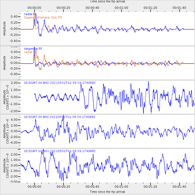
Signal To Noise
| Channel | StoN | STA | LTA |
| US:DGMT:00:BHZ:20210501T01:38:39.174988Z | 12.963279 | 2.094215E-6 | 1.6154979E-7 |
| US:DGMT:00:BH1:20210501T01:38:39.174988Z | 5.422687 | 1.2760961E-6 | 2.3532542E-7 |
| US:DGMT:00:BH2:20210501T01:38:39.174988Z | 2.9169893 | 8.5338763E-7 | 2.9255767E-7 |
| Arrivals |
| Ps | |
| PpPs | |
| PsPs/PpSs | |


