You are here: Home > Network List > US - United States National Seismic Network Stations List
> Station HAWA Hanford, Washington, USA > Earthquake Result Viewer
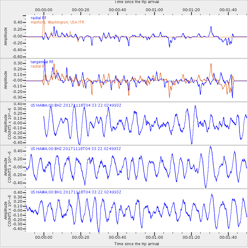
HAWA Hanford, Washington, USA - Earthquake Result Viewer
*The percent match for this event was below the threshold and hence no stack was calculated.
| Earthquake location: |
Near Coast Of Ecuador |
| Earthquake latitude/longitude: |
-3.0/-79.7 |
| Earthquake time(UTC): |
2017/11/18 (322) 04:23:46 GMT |
| Earthquake Depth: |
35 km |
| Earthquake Magnitude: |
5.5 Mww |
| Earthquake Catalog/Contributor: |
NEIC PDE/us |
|
| Network: |
US United States National Seismic Network |
| Station: |
HAWA Hanford, Washington, USA |
| Lat/Lon: |
46.39 N/119.53 W |
| Elevation: |
364 m |
|
| Distance: |
60.4 deg |
| Az: |
329.349 deg |
| Baz: |
132.644 deg |
| Ray Param: |
$rayparam |
*The percent match for this event was below the threshold and hence was not used in the summary stack. |
|
| Radial Match: |
60.639496 % |
| Radial Bump: |
400 |
| Transverse Match: |
69.71805 % |
| Transverse Bump: |
400 |
| SOD ConfigId: |
2429771 |
| Insert Time: |
2017-12-02 04:26:40.989 +0000 |
| GWidth: |
2.5 |
| Max Bumps: |
400 |
| Tol: |
0.001 |
|
Signal To Noise
| Channel | StoN | STA | LTA |
| US:HAWA:00:BHZ:20171118T04:33:22.024993Z | 0.40962622 | 1.1750786E-7 | 2.8686608E-7 |
| US:HAWA:00:BH1:20171118T04:33:22.024993Z | 0.9376271 | 1.6466379E-7 | 1.7561757E-7 |
| US:HAWA:00:BH2:20171118T04:33:22.024993Z | 0.6869643 | 1.4353633E-7 | 2.0894292E-7 |
| Arrivals |
| Ps | |
| PpPs | |
| PsPs/PpSs | |


