You are here: Home > Network List > CI - Caltech Regional Seismic Network Stations List
> Station MPM Manuel Prospect Mine, California, USA > Earthquake Result Viewer
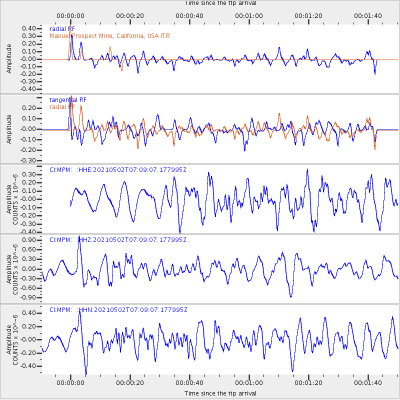
MPM Manuel Prospect Mine, California, USA - Earthquake Result Viewer
*The percent match for this event was below the threshold and hence no stack was calculated.
| Earthquake location: |
Near Coast Of Central Chile |
| Earthquake latitude/longitude: |
-30.1/-71.6 |
| Earthquake time(UTC): |
2021/05/02 (122) 06:57:38 GMT |
| Earthquake Depth: |
31 km |
| Earthquake Magnitude: |
5.8 Mww |
| Earthquake Catalog/Contributor: |
NEIC PDE/us |
|
| Network: |
CI Caltech Regional Seismic Network |
| Station: |
MPM Manuel Prospect Mine, California, USA |
| Lat/Lon: |
36.06 N/117.49 W |
| Elevation: |
185 m |
|
| Distance: |
78.7 deg |
| Az: |
323.597 deg |
| Baz: |
140.622 deg |
| Ray Param: |
$rayparam |
*The percent match for this event was below the threshold and hence was not used in the summary stack. |
|
| Radial Match: |
58.17781 % |
| Radial Bump: |
400 |
| Transverse Match: |
74.07008 % |
| Transverse Bump: |
400 |
| SOD ConfigId: |
24828478 |
| Insert Time: |
2021-05-16 07:08:21.975 +0000 |
| GWidth: |
2.5 |
| Max Bumps: |
400 |
| Tol: |
0.001 |
|
Signal To Noise
| Channel | StoN | STA | LTA |
| CI:MPM: :HHZ:20210502T07:09:07.177995Z | 2.0697544 | 4.1566307E-7 | 2.0082724E-7 |
| CI:MPM: :HHN:20210502T07:09:07.177995Z | 1.7154363 | 2.0688253E-7 | 1.2060053E-7 |
| CI:MPM: :HHE:20210502T07:09:07.177995Z | 1.2011055 | 1.4566703E-7 | 1.2127747E-7 |
| Arrivals |
| Ps | |
| PpPs | |
| PsPs/PpSs | |


